Zeph1 - All Post
thumbnail

Best Places to Visit in Hopkinsville, Christian County, Kentucky

Founding of Hopkinsville

Hopkinsville, located in Southwest Kentucky, is a city of over 32,000 residents. Settled in 1796, and officially founded in 1804, Hopkinsville offers a rich history and rich historical sites for visitors to experience. The city's first settlers were Bartholomew Wood and his wife Martha after they received 1,200 acres of land as 'reward' for his service during the Revolutionary War. Once Christian County was officially founded later that year, Bartholomew and Martha donated five acres to the newly-formed county government.

Christian County courthouse Kentucky
By Bedford at en.wikipedia (
Own work Transferred from en.wikipedia)
[Public domain], via Wikimedia Commons
From there, in 1798, development of the area was well under way, including a courthouse and jail. After a short 'fight' over what the town would be named, with one recommendation being the name of Woods' daughter Elizabeth, the town became officially known as Hopkinsville. The city was named after state representative and veteran, Samuel Hopkins.

Points of Interest in Hopkinsville

Though not exhaustive, here are some of the points of interests and places to see in and around Hopkinsville, Kentucky.

Visit the official websites of each attraction for more information.

Charles Jackson Circus Museum

A collection of circus memorabilia, including items from Ringling Bros and Barnum and Bailey.

Hopkinsville Museum
By Bedford at en.wikipedia
(Own work Transferred from en.wikipedia)
[Public domain], via Wikimedia Commons
Pennyroyal Area Museum

Learn about Edgar Cayce (born in Hopkinsville), military heroes and local African-American history.

Woody Winfree Fire-Transportation Museum

See a collection of classic cars, buggies, an antique fire truck and more.

Don F. Pratt Memorial Museum

As a part of Fort Campbell, this museum features the history of the 101st Airborne's "Screaming Eagles" and their missions during wartime, from World War II up to Operation Desert Storm. Also displayed are military equipment, aircraft, and monuments.

Bramble & Bee Farm

Bramble & Bee Farm offers raw honey, jams and jellies, canned goods, and organic produce for sale at local shops and the local farmer's market. They also offer many products produced from honey and beeswax.

Copper Canyon Ranch

Copper Canyon is an attraction designed to look like an Old West town. Open for picnics, field trips, public visits. Seasonal events, such as their "Haunted Ghost Town" around Halloween, are open for all.

MB Roland Distillery

A Small-scale distillery that offers free tours for visitors offering taste-testing and the purchasing of their products. They produce rums, whiskeys, "True Kentucky Shine", and other alcoholic beverages.

Tie Breaker Family Aquatic Center

The Tie Breaker Family Aquatic Center is a water park that features Ripple River, a slow-moving 'river' for visitors to float down, The Splash Zone (a playground with small water slides and other equipment), and larger slides, Riptide Express, and Hurricane Alley. Also available are poolside concession stands.

Pennyroyal Scuba Blue Springs Resort

An old quarry, turned into a dive site, with water depths ranging from 5 feet to 130 feet. Scuba diving experiences are available for the beginner to the experienced divers. There are over 40 'sunken treasure' locations for divers to explore. Also available are equipment rentals, tank refills, diving classes and a service department at the dive shop.

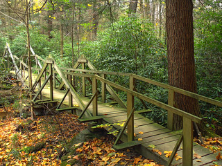
Pennyrile Forest State Resort Park

A state park with plentiful woods surrounding it, lodging and cabins for rent, camping sites, natural trails, fishing areas on Pennyrile Lake, swimming picnic shelters, nature trails and more.

Christian County Historical Society
By Bedford at en.wikipedia (Own workTransferred from en.wikipedia) [Public domain], via Wikimedia Commons

Historic Attractions in Hopkinsville


Historic site with a memorial built for the Confederate president born in the area in 1808.


Honoring the memory of the Cherokee who died on the Trail of Tears after their forced removal from their lands. Also featured are the burial sites of Chief Fly Smith and Chief White Path.


Downtown Hopkinsville features historic homes, with detailed architecture, and many shops, businesses, and numerous other attractions and activities.


Fort Campbell Memorial Park was built in memory of the 248 soldiers, who lost their lives after their plane crashed, in 1985, shortly after takeoff in Gander, Newfoundland, Canada.


Gift Shops


Blue Creek Centre 
4537 Ft. Campbell Boulevard. 
Hopkinsville, KY


100 East 6th Street
Hopkinsville, KY


4259 Fort Campbell Blvd
Hopkinsville, KY


205 Means Avenue
Hopkinsville, Kentucky


911 S Main St
Hopkinsville, Kentucky
thumbnail

Genesee Region State Parks in Western New York

View from Portage Viaduct
Dan Parnell at en.wikipedia [CC BY-SA 3.0
or GFDL], via Wikimedia Commons
The Genesee and Genesee Valley regions of Western New York are known for their many parks, its scenic beauty and rich history. One of the most well-known parks, Letchworth State Park, offers both an interesting history, many places of interest and miles of trails. Including the Genesee River Gorge, giving it the name "Grand Canyon of the East."
About an hour north of Letchworth is Lakeside Beach State Park and a handful of other state parks and beaches within the Genesee region. Most of which provide camping, swimming, outdoor activities and even fishing in some of the locations.

Letchworth State Park

Letchworth State Park is in the area of what was once the home of Mary Jemison and the Seneca. The "Grand Canyon of the East" is one of the most scenic areas in the state. The Genesee River flows through the middle of Letchworth Park with three waterfalls at different points of the river within the park. There are over 60 miles of hiking trails. Which includes specialized trails for biking, snowmobiling, skiing and horseback riding. Activities at the park include guided walks and tours, programs about nature and the local history, whitewater rafting, boating, and kayaking. There's also a pool available for swimming and hot air ballooning at the nearby, "Balloons Over Letchworth".
Not only are there plenty of spring and summer activities are Letchworth State Park but there's also winter activities for visitors. Which include cross-country skiing, snow tubing, sledding, and snowmobiling. At the Glen Iris Inn, many services are available and open to the public. Which include breakfast, lunch, and dinner. They also offer rooms and reservations for special events.


Conesus Lake and Conesus Lake Public Boat Launch

Conesus Lake 
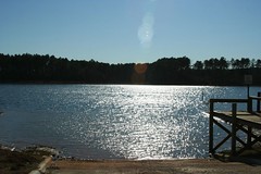
offers those who enjoy boating and fishing easy access to the lake with many different species of bass, trout and other fish in its waters. You can even fish from the docks. The lake is also open in the winter for ice fishing. For those looking just to visit and not go out onto the lake, there are plenty of picnic sites. For campers, there are campsites open for tents and RVs and on-site cabins, cottages and trailers available for rent.
A yearly tradition also takes place on the night of July 3rd for the 4th of July holiday. Called the "Ring of Fire", people staying at the lake light up thousands of road flares around the whole lake at dusk and shoot off fireworks. During the day, you can engage in activities beyond just fishing or having a picnic though. You can go scuba diving, water skiing, sailing or just sit back and relax if that's your thing.
Conesus Lake panorama
Benjamin D. Esham / Wikimedia Commons [CC BY-SA 3.0 us], via Wikimedia Commons


Darien Lakes State Park

Darien Lakes State Park, not to be confused with the theme park nearby. The park was originally called Harlow Lake and Park and was created in the summer of 1960. It provides over 150 seasonal campsites, most of which providing electric hookups for RVS and trailers. There's also a small beach at one part of the lake. Elsewhere around the park, there are rest stations, showers, playgrounds, areas for fishing, trails for hiking and horse-riding. Some of which are also open in winter for skiing and snowmobiling. For picnicking. there are two picnic shelters (requiring a reservation) and numerous picnic tables with grills nearby, including across the small bridge to Picnic Island.

Genesee Valley Greenway State Park

Genesee Valley Greenway State Park roughly follows the Genesee River. Much of the park is a trail that stretches for 90 miles along what was once the Pennsylvania Railroad path and along the Genesee Valley Canal. The trail is open to public for biking and walking. Along the trail, you'll find a few areas of historical and natural significance. Being made from the former Pennsylvania Railroad path, much of the trail is level with cinder, gravel and short grass and not just a dirt path. While passing through the Genesee Valley Greenway, you'll find plenty of environments including marshes and wetlands, woodlands, streams and river valleys, gorges, farmland, the area's long-standing villages and more. The trail also connects up with the Finger Lakes Trail, Erie Attica Trail, Lehigh Valley Trail, the Genesee River Trail and the Erie Canal Recreation Way.


Silver Lake State Park

Silver Lake State Park offers visitors a quiet day vacation getaway. There are many boat launch sites, picnic areas and restroom areas on and in the area of the parklands. But most of the park isn't developed, allowing it to keep its natural beauty. On West Lake Road, in the southwest corner of the lake, not far past Silver Lake Marine, is a boat launch open to the public. On the eastern side of the lake, there are a few boat rental businesses and public boat launch sites. The public boat launch is suited for rowboats, canoes, kayaks and small motor boats. While other sites can handle larger boats. So it's best to do a little research on the boat launch locations before visiting. The two links below provide much more information about Silver Lake and the State Park.


Oak Orchard State Marine Park

Oak Orchard State Marine Park is open from April 15th to November 1st, offering picnic areas with grills, boat launch sites, showers and restroom areas, an overlook, and many seasonal events. Events which include a car show, a series of concerts, a fishing tournament. Visitors can also reserve, in advance, the park and pavilions for events and gatherings.

Irondequoit Bay State Marine Park

Irondequoit Bay Marine park has 30 acres of land and offers fishing, boating on Lake Ontario and Irondequoit Bay. There is a small restroom area for visitors and clean out stations for boaters who visit the park. The park is open from April 1st to October 31st, 6:00 am until 8:00 PM. Besides fishing and boating, there are also geocaches located around the park.


Hamlin Beach State Park

Hamlin Beach features over 250 campsites for tents and trailers, numerous shaded picnic sites with grills and picnic tables. On the east side of the State Park is the mile-long nature trail that's for visitors. Elsewhere on the park grounds, mainly near the lakeside, are miles of hiking trails, which visitors are also permitted to use bikes on. In winter, there are numerous snowmobile and skiing trails. For those who enjoy time on the lake, or fishing, you can bring small (car-top) boats and launch them from an area on the eastern side of the park.


Lakeside Beach State Park

Lakeside Beach State Park
By The original uploader was Decumanus at
English Wikipedia [GFDL or CC-BY-SA-3.0],
via Wikimedia Commons
Lakeside Beach State Park is a well-kept, peaceful scenic park offering 274 camping sites, miles of hiking and biking trails, picnic areas, restrooms, fishing, open playing fields and a disc golf course with 18 holes to play through. There are separate pets and no pets areas for convenience and comfort. On the grounds, there are also a few playgrounds and a camping supply store.
The downside is that there is no swimming allowed at this park but you can head to Hamlin Beach with your camping pass. Though it's about a 20-minute trip to Hamlin Beach. In winter, Lakeside offers hiking, snowmobiling and ski trails.
thumbnail

The Mound Builders of Western New York - An Unknown Tribe

Aboriginal Occupation of the Lower Genesee Country
Excerpts from Aboriginal Occupation of the Lower Genesee Country by George Henry Harris - 1884
The discovery of several tall, 7 and 8 foot skeletons in multiple 
burial mounds around Western New York
Near the top of a high ridge of sand hills, in the town of Pittsford, south 
of the Irondequoit valley, and about one mile east of Allen's creek, stands a 
great heap of limestone boulders, evidently of drift origin. They are the only 
stone of that character in that vicinity, measure from two to three feet in 
diameter, and are heaped one upon the other in a space about twelve feet 
square. They occupied the same place and position sixty or seventy years 
ago, and old residents say the heap existed in the same form when the ground 
was cleared. Indians who passed that way in early days regarded the stones 
with superstitious awe, stating, when questioned, that a people who lived there 
before the Indians brought the stones to the hilltop. 
"On the shore of Lake Ontario, on a high bluff near Irondequoit bay, in 
1796," says Oliver Culver, "the bank caved off and untombed a great quantity 
of human bones, of a large size. The arm and leg bones, upon comparison, 
were much larger than those of our own race."' The bluff mentioned by Mr. 
Culver was the seaward side of an elevated spot that might properly be 
termed a natural mound. It was one of the outlying range of sand hills or 
knolls, then existent along the shore of the lake in that locality, and long 
years ago succumbed to the never-ceasing encroachment of the lake waters. 
Its location was immediately west of the angle formed by the present west 
line of Irondequoit bay and Lake Ontario; as late as 1830 human bones of an 
unusually large size were occasionally seen projecting from the face of the 
bluff, or lying on the beach where the undermined soil had fallen. The tribe 
of Seneca Indians living in Irondequoit in 1796 could give no information 
concerning these bones, stating their belief that they were the remains of a 
people who dwelt about the bay before the Indians came there. 
In 1880 a sand bank was opened in the side of the ridge, and that part 
covered by the mounds has since been entirely removed. During the course 
of excavation a laborer came upon human remains. Parts of eight skeletons 
were exhumed, each surrounded by fine black soil. These were concealed and 
all evidence of the find destroyed; but the discovery of a bone of unusual 
size, together with a curious pipe, was brought to the attention of Mr. Brewer. 
The laborer could remember few details of the position in which the remains 
were found, and the opportunity for careful investigation was lost. 

The Mound-builders were inveterate smokers, and great numbers of pipes 
have been found in their mounds. The skill of the makers seems to have been 
exhausted in their construction, and no specimens of Indian art can equal those 
of the lost race. Many pipes of a shape similar to those discovered in the 
mounds of the Ohio and Mississippi valleys have been found in various parts 
of the country. 
smoking pipe artifact
Figure 1 is a greatly reduced representation of an article of stone, evidently intended for a pipe, but unfinished, found near Mount Morris, in the Genesee valley, and sent to the New York state cabinet at Albany by Mr. Squier, who says: "It is composed of steatite or 'soap-stone,' and in shape corresponds generally with the pipes of stone found in the mounds of the Mississippi valley. One or two pipes of stone of very nearly the same shape have been found in the same vicinity, but in point of symmetry or finish they are in no way comparable to those of the mounds."' The pipe taken from the ridge mound in Rochester is of the distinctively characteristic, or primitive form^ peculiar to the Mound-builders, and is represented in figure 2.
smoking pipe artifact
It is, or was originally, five and one-half inches long, one and three-fourths wide, and one inch and seven-eighths from bottom of base to top of bowl. The lines are slightly irregular, but very perfect for a hand-made article. The material is steatite, very close grain and quite brittle.
In the color it is a deep, rich brown, with blending patches of lighter shade, 
and every particle of the surface is so beautifully polished that it might easily be 
mistaken for marble. It was the only article of any description found with the human 
remains, though other relics may have been unnoticed. Close questioning elicited the 
fact that nearly all the graves were near the south slope of the ridge, and from two to 
two and a half feet below the original surface, while the large bone, a humerus, 
was nearer the surface and perhaps more directly beneath the center of the west 
mound; from which it may be inferred, though not definitely proven, that the 
mound was built over that particular bod)' with which the pipe was buried, and 
the other bodies interred in the side of the mound at a subsequent period. 
The condition of the remains would seem to fivor this view, the humerus 
being the only remaining part of the body to which it belonged, while several 
portions of skeletons from the other graves were, though very much decayed. 
quite firm in comparison; one skull (figure 3 being preserved entire.)
unique skull
Mr. Brewer presented this skull and pipe to Professor S A. Lattimore of the Uni- versity of Rochester, to whom we are indebted for their use. In March, 1882, a human skeleton of large proportions was unearthed near the former location of the east mound. The laborers, astonished at the great size of the bones, engaged in a discussion as to whether it was or was not the remains of a human being, and, with true Hibernian method, broke the skele- ton into fragments to prove the ease.
Read the Rest, including the discovery of a skeleton over eight 
feet in height at Samuel Truesdale's farm in Greece, in 1878


thumbnail

Women of the Revolutionary War - Nancy Morgan Hart

Nancy Ann Hart (née Morgan) was born in 1735 in North Carolina to her parents Thomas and Rebecca Morgan (née Alexander). She came from a family line of well-known figures in our nation's history, including General Daniel Morgan (her cousin and Revolutionary War hero) and Daniel Boone. Around the year 1760, she met and married Benjamin Hart.

Nancy Hart's Childhood

Not much is known about her childhood, but it is clear that she was raised in a family of proud and independent frontier people. Nancy Hart was a spirited and fearless young woman, and she would need all of her courage in the years to come.

Nancy Hart - The Heroine

In her mid-30s, the 1770s, she and her family moved to Georgia, to the region of Elberton. This was after Nancy and Benjamin Hart were married in 1760. Their home was near the Broad River and they owned more than 400 acres of the land, with some of it along the banks of the Wahatchee Creek. The name of the creek, meaning War Woman, was said to be named for Nancy by local Native Americans. Though this may not be true as the name for the creek seems to have existed before she moved there.

Nancy Hart
Nancy Morgan Hart and Sukey against the Tories
By Illustrator not credited. [Public domain],
via Wikimedia Commons
Nancy Morgan Hart was a intimidating red-haired woman who stood over 6 feet tall. Her face was scarred from getting smallpox when she was younger. She was also hard-headed and could stand up to and swear with the best of men. Due to this, she became notorious in her area and also respected by many. Before the Revolutionary War, she learned to shoot well and to do the job of a doctor, treating her family members and neighbors when needed. She grew a garden of medicinal herbs to help her in her doctoring. She was also a very patriotic women and was very anti-Tory. She ran her farm as her husband spied on the Tories . She'd also done the same on a few occasions by playing a role of a stupid person and spying on Tories in their own camps. Another time, she gained information, for the Continental Army, while posing as a seller peddling houseware and eggs. She also got information for Major General Benjamin Lincoln and Henry Lee III.

What earned her status as a heroine of the Revolutionary War was on a day when she was doing work around their homestead, along with her 13-year-old daughter Sukey, when some Tory soldiers showed up at their home and demanded to be fed. Nancy went on to tell them that they only had one living turkey since previous Tory soldiers came and took turkeys. So, in response, the Tories took her last turkey and shot it and told her to cook it. She had no choice but to cook the turkey since it was clear that they were not leaving. As she cooked, she told stories to the Tories to put them at ease as they drank. While eating and drinking some more, Nancy saw that they relaxed enough and sent her daughter out to get water from their well. Before her daughter left the home, she whispered to her to blow their conch shell horn by the well to alert their neighbors that they needed some help. The sound alerted her Nancy's husband Benjamin, who was at work nearby, It also alerted their neighbors at the same time.

This is while Nancy, still in the house, was carefully gathering the Tories guns and concealing them in her skirts and then sliding them out through openings in their walls that were used to shoot through in defense of the home, during Indian raids and other assaults on their home. Unfortunately, what she was doing was seen by one of the soldiers and they tried to pull their guy, thinking that Nancy wasn't watching. He was quickly shot by Nancy. Another soldier tried to pull his gun and was shot by Nancy, all the same. Help finally arrived, her husband and the neighbors, and then they were about to shoot at the Tories. It's said that Nancy decided shooting them would be too good for them. Especially after her hearing that they shot a neighbor of hers, Colonel John Dooly. They took the Tory soldiers behind her home and hung them all from a tree.

The incident was never written down and was instead passed along as some tall tale. That is until around 150 years after the incident, in 1922, the burial spots of the Tory soldiers were discovered when ground was being graded for the railroad.

Today, a replica of Nancy's cabin, built on the same site as the original in the 1930s, are part of a 5-acre park in Elberton, Georgia. In nearby Hartwell stands a statue of Nancy Morgan Hart. There's also a section of a highway named in her honor and the county of Hart was also named in her memory. Nancy Hart is buried in the Book Cemetery in Henderson, Kentucky

More about Nancy Morgan Hart:

Feisty Females: Nancy Morgan Hart, War Woman
Nancy Hart Revolutionary Heroine
Nancy Hart 1735-1830 "Poor Nancy-she was a honey of a patriot, but the devil of a wife!"
Northeast Georgia Mountains / Elberton - Nancy Hart Log Cabin
Hart, Nancy Morgan  - American Revolution Reference Library, 2000 From U.S. History in Context

Nancy and Benjamin Hart's Children: 
Sons: Morgan, John, Thomas, Benjamin, Lemuel, and Mark
Daughters: Sarah, Keziah, and Sukey.
thumbnail

Deborah Sampson Gannett - Women Soldiers of the Revolutionary War

While the Revolutionary War is often remembered for the bravery of men who fought on the frontlines, countless women and even children played critical roles in supporting the war effort. Their contributions, though often overlooked or lost to history, were vital to the fight against British rule. These unsung heroes cared for soldiers, volunteered their time, and risked their lives, leaving an indelible mark on the nation’s history.

Sybil Ludington is one of the most celebrated women of the Revolutionary War, earning the nickname "The Female Paul Revere" At 16, Ludington undertook a daring night ride to alert militia forces about British troop movements. On a rainy night in 1777, she rode 40 miles through rural New York, stopping at multiple locations to rally troops. Her efforts enabled the militia to organize and repel British forces, forcing them to retreat to their ships near Long Island. Though her story is less widely known than Revere’s, her bravery and determination were crucial to the war effort.

Deborah Sampson: A Soldier in Disguise

Deborah Sampson Gannett’s story is one of remarkable courage and resilience. Born in Massachusetts, Sampson worked as a teacher in her late teens while witnessing British forces tighten their control over Boston. She saw homes seized by soldiers, freedoms restricted, and tensions rise among colonists. Inspired by the reading of the Declaration of Independence in 1776, Sampson decided to join the fight for liberty—a bold decision for a woman at the time.

In 1782, Deborah Sampson disguised herself as a man and enlisted in the Continental Army under the name Robert Shurtleff. Though initially nervous about reporting for duty, she persisted and joined Captain George Webb’s company in the 4th Massachusetts Regiment. Her disguise was convincing enough to pass muster and earn her a place among her fellow soldiers.

DeborahSampson
Engraving by George Graham. From a drawing by William Beastall, which was based on a painting by Joseph Stone. Used as the frontispiece of The Female Review: Life of Deborah Sampson, the Female Soldier in the War of Revolution, by Herman Mann (1771-1833). [Public domain], via Wikimedia Commons

Service and Sacrifice

Sampson’s regiment was deployed to lower New York to combat guerrilla attacks. During a battle near Tarrytown, she sustained injuries to her head and thigh while retreating with her unit. Although her head wound was treated at a field hospital, she concealed her thigh injury from doctors out of fear that her true identity would be discovered. Attempting to treat herself, she left a musket ball lodged in her leg, which caused long-term complications.

Despite these hardships, Sampson returned to active duty after recovering from her injuries. However, she later fell ill and was sent to recuperate at a doctor’s home. During treatment, the doctor discovered her secret and informed military officials. On October 23, 1783, Sampson was honorably discharged from service. Her fellow soldiers respected "Robert Shurtleff" as a brave comrade but never knew she had been living as Deborah Sampson.

Life After the War

After leaving the army, Sampson married Benjamin Gannett and settled in Massachusetts. The couple faced financial difficulties throughout their marriage and often relied on borrowed money to make ends meet. Paul Revere, a friend of Sampson’s, advocated on her behalf and secured back pay from the Massachusetts government totaling 37 pounds—a modest sum that did little to alleviate their debts.

To support her family further, Sampson became the first woman in America to deliver public lectures about her wartime experiences. Traveling from city to city, she shared her story of courage and sacrifice during the Revolutionary War. Though these lectures brought some income, they were not enough to resolve her financial struggles.

In the early 1800s, Sampson was awarded a veteran’s pension of $4 per month—a small but significant acknowledgment of her service. After her death on April 19, 1827, at age 67 in Sharon, Massachusetts, her pension was transferred to her husband until his passing.

Legacy

Both Sybil Ludington and Deborah Sampson exemplify the bravery and determination of women who contributed to America’s fight for independence. Their stories remind us that history is shaped not only by those who lead armies but also by those who defy expectations and rise to extraordinary challenges. While their names may not be as widely recognized as others from the Revolutionary War era, their contributions remain an essential part of our nation’s story—one that deserves continued acknowledgment and celebration.

Citations:

thumbnail

Elba, New York's Role in the Underground Railroad

The Underground Railroad in New York State played a big part in helping slaves escape and throughout NYS, many smaller towns served as stops for escaped slaves to make the way on to Canada. The Town of Elba's involvement isn't well-documented and that's somewhat due to the secrecy of its participation at the time.

Small Town !

The route in Western New York 
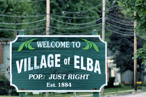
passed through Rochester from Farmington. From Rochester, they would either continue on to Gaines and on to Lockport or to Elba on to LeRoy. These escaped slaves would make their way to stop points under the cover of night. Marking these stops, one such stop being in Elba, were tree branches. The branch markers would be around 2 feet in height and inconspicuously stuck in the ground near a fence near a roadway. They were also stuck on a street corner in such a way to also tell the direction for them to turn and head to find their stop.

In Elba, three buildings were used to shelter and hide escaped slaves before they continued on to LeRoy. These buildings are on North Main Street and were the Warren Shamp house, the home of Colonel Elias Pettibone, and the Willis Tavern. In the Pettibone home, a dutch oven hid a tunnel in the cellar that connected under the street to the Willis Tavern. There was also a second tunnel in the Pettibone home that led to a long torn down barn that stood behind the Presbyterian Church. The tunnel at the former Pettibone home was covered over by solid flooring but still exists. As the tunnel was likely never filled in.


At the tavern, the was a trap door where the escaped slaves would have been hidden. As for the Shamp home, its history wasn't discovered until 1993. This was after a pre-sale inspection of the home lead to the discovery of a small area under one of the rooms. This small was was also walled off in the basement by a stone wall.

As i said, the Underground Railroad in Elba isn't all that well documented. Yet, it played a crucial part as slaves made their way to Canada or tried to shake slave catchers on their trail. To this day, the town takes pride in playing their part in aiding slaves in escaping their captors. When i was younger, elementary school aged, our class took a history tour through the town in the early 90s. We didn't get to see inside the buildings where the tunnels were but the history of Elba's Underground Railroad has stuck with me since then. It's the town i grew up in and its rich history makes me proud to have experienced living there.


thumbnail

Queen Aliquippa - Seneca Leader and Ally of George Washington

Queen Aliquippa (also spelled Allaquippa) was the leader of the Mingo band of Seneca. Many places have been named for her, including the town of Aliquippa in Beaver County, Pennsylvania. She'd also lived in that region prior to the 1750s. It is believed that one of her children, as son, was named Canachquasy (Kanuksusy). She and her husband visited the founder of Pennsylvania, William Penn, at New Castle, Delaware prior to him leaving for England, for the final time, in the autumn of 1701.

Alliquippa
Washington and Gist visit Queen Aliquippa. 1756
By Rogers, John, ca. 1808-ca. 1888 [Public domain], via Wikimedia Commons
It wasn't until the summer months of 1748 when Queen Aliquippa was mentioned again. Conrad Weiser, who was in the region of Logstown was looking to enter tribes into a treaty with Pennsylvania. At the time, Queen Aliquippa was living in a village on the north bank of of the Allegheny River and a short distance from the Monongahela River.

She is mentioned in an August 27th, 1748 entry in Weiser's journal, as such: "Set off again in the morning early. Rainy weather. We dined at a Seneca town where an old Seneca woman [Queen Allaquippa] reigns with great authority. We dined at her house and they all used us very well."

Weiser left Queen Aliquippa's house and arrived at Logstown in the evening. At George Groghan's trading post, he made it into his headquarters for as long as he was was in Logstown. During his stay, he'd reached out to the Kuskuskies near Sauconk. He'd also met with Queen Aliquippa again between the end of August and September 19th (the day he left Logstown).

The entry in his entry was written: "The old Sinicker Queen from above, already mentioned, came to inform me some time ago that she had sent a string of wampum of three fathoms to Philadelphia by James Dunnings, to desire her brethren would send her up a cask of powder and some small shot to enable her to send out the Indian boys to kill turkeys and other fowls for her, whilst the men were gone to war against the French, that they may not be starved. I told her I had heard nothing of her message, but if she had told me of it before I had parted with all the powder and lead, I could have let her have some, and promised I would make inquiry; perhaps her messenger had lost it on the way to Philadelphia. I gave her a shirt, a Dutch wooden pipe and some tobacco. She seemed to have taken a little affront because I took not sufficient notice of her in coming down. I told her she acted very imprudently not to let me know by some of her friends who she was, as she knew very well I could not know by myself. She was satisfied, and went away with a deal of kind expressions."

By the Summer of 1749, Queen Aliquippa was seen by Pierre Joseph Céloron de Blainville near Shannopin's Town. Which was located on the east bank of the Allegheny River and also in the region of Pittsburgh. He wrote is his journal: "I re-embarked and visited the village which is called the Written Rock. The Iroquois inhabit this place, and it is an old woman of this nation who governs it. She regards herself as sovereign. She is entirely devoted to the English."

The Commissioners of Virginia, going by the names of Lomax, Fry, and Patten, arrived in the area of Logstown in 1752 and were looking to meet with Queen Aliquippa. She now was living on the south bank of the Ohio River and below the mouth of Chartiers Creek. They met on May 30, 1752 and she presented them with wampum and a 'fine dish of fish' and other provisions for their continuance on to Logstown. In return, they presented her with a brass kettle, tobacco, and other items and went on their way.

George Washington had also visited Queen Aliquippa in 1753. At this time, she was living in the area of present-day McKeesport, in Allegheny County. Washington traveled three miles to the mouth of the Youghiogheny River to visit her. During the visit, her presented her with a match coat and a bottle of rum. Washington expressed in his journal, about the gifts, "...which latter was thought much the better present of the two." He visited her out of his appreciation for her, her son, and warriors from her Mingo band for traveling to Fort Necessity to aid him. Though they did not play an active role in the Battle of Great Meadows.

After Washington's loss (as part of the British command leadership) against the French and their Native allies, he surrendered at Fort Necessity on July 4th, 1754. Meanwhile, Queen Aliquippa left the fort and moved on with her band and other tribes from the Fort Necessity region. They settled in Aughwick Valley in Huntingdon County, Pennsylvania. She was found dead on December 23, 1754 and it was thought she had passed prior to this date. George Croghan, in charge of Indian affairs at Aughwick, wrote to Colonial Authorities: ""Alequeapy, ye old quine (queen), is dead."

Her birth year is unknown, but it is estimated to be between the year 1670 and the early 1700s. Being that she and her husband may have visited William Penn in 1701, she was possibly born in the 1680s.

 
thumbnail

Sybil Ludington - The Female Paul Revere

Ludington statue 800
Anthony22 at the English language Wikipedia
[GFDL, CC-BY-SA-3.0 or Public domain],
  via Wikimedia Commons
Sybil Ludington, whose father was Colonel Henry Ludington, is not know to most. On the night of April 26, 1777, word got out that British troops were preparing to invade Danbury, Connecticut. The 16-year-old Ludington took off on horseback that and traveled first to Danbury to warn its citizens. From there, she continued on to alert the militiamen under her father's leadership. The whole trip was around 40 miles and more than twice the distance that Paul Revere had to travel on horseback.

Thanks to her, she may have saved the lives of many in Danbury. The afternoon after Sybil traveled through Danbury, the British troops reached the city and burned down three buildings and an unknown number of houses. Unfortunately, some citizens in Danbury were killed by the British. According to family recollections, as written by her great grandson, she left at 9 PM and didn't finish the ride until the sun was rising. She followed a path from Carmel and on to Mahopac. From there, she went onto Kent Cliffs, to Farmers Mills and back home. She had a stick with her that she used to keep her horse going, to knock on doors of citizens to warn them, and to even fight off a highwayman (a thief that robs travelers). She'd returned home tired and rain-drenched after warning the militia force of 400 troops and her father of the British movements.

The militiamen didn't make it in time to defend Danbury, but were able to push New York Colonial Governor General Williams Tryon and his men back to the Long Island Sound. For her brave actions, she became deeply respected in her neighborhood, by her friends, and was even thanked by George Washington, a general at the time.

Other facts about Sybil Ludington:

- Her name is spelled "Sibbell" on her gravestone at Maple Avenue Cemetery, Patterson, New York
- There is a historical marker at the cemetery telling of Sybil and Henry. Both of whom are buried in the cemetery
- A statue is dedicated to her in Carmel, New York.
- She was born on April 5, 1761 in Kent, New York and died on February 26, 1839 at the age of 77 in     Catskill, New York.

More about Sybil Ludington at historicpatterson.org
thumbnail

Shikellamy - Oneida Chief and Iroquois Representative in Pennsylvania

Appletons' Swatane
By Jacques Reich (probably based on an 
earlier work by another artist) 
[Public domain], via Wikimedia Commons
Born around 1690 in New York State, Shikellamy (sometimes spelled Shikellimy, also known as Swatane) was originally a member of the Susquehannock tribe. Though Susquehannocks referred to themselves as Andastes. When the tribe settled at Conestoga, they gave up war and disagreeing members left the tribe and joined other tribes. Shikellamy was one of the individuals to leave the Andastes and joined up with the Oneida. He became a part of the Oquacho (Wolf Tribe). It's said that he rose quickly within the tribe and was a leader amongst the tribe. By the year of 1728, he was the representative of the Six Nations in dealings with the proprietary colonial government. He even became favorable amongst the English.

In the summer of 1745, Shikellamy visited Bethlehem, Pennsylvania and spent three weeks there. During the time, he met with many men and made friendships with them. Of all the visitors in that summer, he was the one that was most revered, impressive and respected in the eyes of the English there. Shikellamy was shown the schools and met with students in the (back then) small town. 

After the visit, Bishop Spangenberg, Conrad Weiser, John Joseph, David Zeisberger, Shikellamy, his son John, and Andrew Sattelihu, traveled on to Onondaga, an Iroquois settlement. On this journey, Shikellamy gave the Bishop the name T'girhitonti which meant "row of trees'. John Joseph received the name Hajingonis (one who twists tobacco), David Zeisberger got the the name Ganonsseracheri (on the pumpkin). This would've been around June 10, 1745. Shikellamy served as the voice between the English and the Iroquois in Onondaga. He was also a guide to Conrad Weiser for many years.

He moved to Shamokin (near modern-day Sudbury) in 1742 and spent his last years there, dying on December 6, 1748

Read More about Shikellamy:

Best sources:
Otzinachson: A History of the West Branch Valley of the Susquehanna

On the Frontier with Colonel Antes: Or, The Struggle for Supremacy of the Red and White Races in Pennsylvania

Bishop J. C. F. Cammerhoff's narrative of a journey to Shamokin, Penna. in the winter of 1748

Quick facts:
https://en.wikipedia.org/wiki/Shikellamy


thumbnail

Central Pennsylvania's Standing Stone Trail

Windy View, Standing Stone Trail

The Standing Stone Trail (2), once known as the Link Trail, began its planning stages, and was 'constructed' between 1978 and 1982. Its creation was headed a group of dedicated hikers. Once finished, the trail was 68 miles long. It was that length up until 2014 when the Greenwood Spur became part of the trail and increased the length of the trail to around 80 miles. The trail has varying altitudes ranging from around 660 feet up to 2380 feet at its highest place. The Standing Stone trail is also connected to the Tuscarora Trail and the Mid State Trail. Furthermore, the trail is one section of the massive, 1,800 mile Great Eastern Trail that begins near the border of Florida and Alabama all the way to the large Finger Lakes Trail in New York State.

The trail goes through four State Game Lands, the state forests of Rothrock and Buchanan, and Rocky Ridge (near Mapleton). It also passes through the countries of Huntingdon, Mifflin and Fulton. Some sections of the trail goes through private lands whose owners have permitted use for the trail.

If you're traveling north on the trail, and heading through Fulton County, then you'll come upon Vanderbilt's Folly. It is an uncompleted rail that was being built under the guidance of William Vanderbilt to give competition to the Pennsylvania Railroad. This was in the latter-1800s. Many train tunnels were dug through the mountains but the rail was never completed due to the the bankrupting of the rail project. After 1940, many parts of the unfinished railway and a few tunnels became a section of the Pennsylvania Turnpike. Today, one of the tunnels has been abandoned since the Turnpike bypass in 1968.

The name of the trail possibly comes from a Native American trail that was called the Standing Stone Path. It connected Fort Littleton to Fort Standing Stone. Fort Standing Stone which later became Huntingdon. In the mid-1800s, industrialization came to the area and the forests were made into lumber for buildings and homes being built in the area. The forest wood was also used in furnaces to melt the iron ore from the area. Iron became very profitable and the furnaces began to be built all over Central Pennsylvania. The Standing Stone Trail makes use of some of these trails that were used for long-gone railroad grades and logging trails.

At Mapleton, aka Mapleton Depot, the trail goes across the Juniata River at Jacks Narrows. Nearby is the well-known Thousand Steps. The steps were built in the 1950s by workers from the ganister stone. The quarry itself has existed since 1900 and was said to had its most success in the early 1920s. Up there you'll also find an old quarry building.

1000 steps: Dawn over Jacks Narrows

Around a mile eastward from the Thousands Steps were two Native American trails that were called the Frankstown Path and the Juniata Path. In 1744, the trader Jack Armstrong was killed during a time when tensions were high between Native Americans and Settlers. Armstrong was killed in relation to his trading activities with a Delaware. Shikellamy and Conrad Weiser helped keep tensions low by fully investigating the murder. In memory, Jacks Mountain and Jacks Narrows are named after him.

From the highest point and over Jacks Mountain there is beautiful scenery to be seen. For rock climbers, there are a few areas that are good for a challenge. One such 'challenge' is the yellow-blazed trail that leads to Hunter's Rocks. This trail section is also great for hikers and features rare and endangered flowers, including Obolaria, and the endangered Putty Root Orchid. Also, Lady Slippers are in abundance in this area.

The next part of the trail leads to the Stone Mountain and Hawk Watch and also provides excellent views. This section is an easier part of the trail, as the trail is more level for miles. The trail then heads into Greenwood Furnace State Park. The furnace existed from the mid-1800s and was the last to stop being used. In fact, the furnace and many structures from those days are still standing and provide a great visual history. Greenwood Furnace State Park is also a great place to take a rest, have a swim, and have a picnic in the warm summer months.

If you head north on the Greenwood Spur section of the trail, you'll pass the historic Greenwood fire tower. Past that, you'll be in he Alan Seeger Natural Area. It was named after Alan Seeger, who was American poet and WWI French Foreign Legion Volunteer who died in the Battle of the Somme. It was Colonel Henry Shoemaker who named the area. Also, Alan Seeger was the uncle of Pete Seeger. This part of the trail continues on and connects to the Mid State Trail at the Detweiler Run Natural Area.

Alan Seeger Natural Area (Revisited) (3)

Notable places along the trail:

Jacks Narrows and Thousand Steps
Rocky Ridge Natural Area
Stone Mountain and Hawk Watch
Vanderbilt's Folly
Monument Rock
Butler Knob and Throne Room
thumbnail

Waxhaw Massacre - Loyalist Forces and the Continental Army Clash

Battle of Waxhaws
See page for author [Public domain],
via Wikimedia Commons
The Waxhaw Massacre went by many names, The Battle of Waxhaws, Buford's Massacre and the Waxhaws. It was a battle that occurred while the Revolutionary War was in full-swing, on May 29, 1780. The battle took place around the area of Lancaster, South Carolina. Abraham Buford was the leader of the Continental Army forces and Banastre Tarleton led the Loyalist forces. British officer Tarleton sent forward a demand for Buford and his forces to surrender and Buford refused. Tarleton's calvary attacked Buford's men and some of them began to surrender. There was a truce and Buford tried to surrender. That truce ended when a shot hit Tarleton's horse and Tarleton was trapped under his now dead horse. The shot caused the Loyalists and the accompanying British troops to begin an attack. This kept going as Tarleton was still trapped and had no control over his men. Continental soldiers, including those who previously surrendered, were attacked by the Brits. 113 Continental soldiers were killed with sabers, 150 other Continentals were severely injured and were left where they were, and 53 were taken as prisoners by the British forces.

It was the Waxhaw Massacre that became a part of a campaign to increase recruitment in the Continental Army. The massacre also created a lot more anger against the British. The act of his own men is something Tarleton knew was a mistake and once he was no longer trapped, he aided some of the Continental soldiers through ordering medical treatment for them. Casualties on the British side were 5 killed and 12 wounded.

For a more detailed account of the Waxhaw Massacre, see:
https://web.archive.org/web/20081217201035/http://www.rsar.org/military/sherm055.pdf
thumbnail

Founding and History of Plain Dealing, Louisiana

Welcome to Plain Dealing
When the first family arrived at Plain Dealing it was a wilderness over a large area and without development. Before settlers began the move into the area, the federal government pushed the Caddo Tribe off their lands which were at present-day Plain Dealing. In 1839, the federal government looked to profit off these lands (as they had done with seized lands elsewhere) and sold them to families. Many of whom didn't know the story of the area or how the lands were acquired by the federal government. One of the first families to arrive in the area were the Gilmers. It was George Oglethorpe Gilmer and his oldest son, James Blair Gilmer, that purchase the lands from the government. They bought thousands of acres of land along both sides of the Red River. George had also bought an additional 5,000 acres a few miles from their Red River lands. 

After settling in, the Gilmers began to develop the Plain Dealing Plantation. It was named after the plantation that they owned in Virginia. Of course, that's also where the small town got its name. Plain Dealing is also a title that is interpreted as it is written. That the family was honest and had integrity. Which also applies to the town today. Though names don't always represent the truth.

Years passed and Mary Boutwell Gilmer Vance, who was the daughter of James Gilmer, lived in George Gilmer's old home with her husband, Dr. Samuel Whitfield Vance. Mary died in the year 1859 at age 23 and he died on May 18, 1877, at age 50. After Samuel's death their daughter, Sallie Vance, inherited the Plain Dealing Plantation. The George Gilmer home burned down in a fire in 1888.

Sallie Vance had married S.J. Zeigler in 1877. Though he was known to the family earlier on after he came to Bossier Parish around the year 1870. He was a businessman, and first vice-president of the St. Louis Southwestern Railway, and was working on planning the railroad route that would head to Shreveport. So he chose Plain Dealing to serve the railroad as a stop on the way to Shreveport.

The town began to develop and one of the earliest business, a store, was owned by S.J. Zeigler. The store was at the site of the present-day Walker Brothers Drug Store. As interest in the town began to increase, there was an auction held and Mr. Zeigler arranged for trains to be brought in. These trains carried those who were looking to purchase auctioned lots. A total of 348 lots were sold for a combined sum of $11,414.50.

Prior to the town being named Plain Dealing, it was briefly known as Guernshein after the name of a major stockholder of the railroad company. The town of Plain Dealing became official on April 24, 1890. At the time, the town had less than 100 residents. William Benton Boggs became the town's first mayor after he took office on April 5th, 1890. He would also later become an organizer and president of Plain Dealing first bank and a state senator.

In 1891, Mr. Zeigler donated land for the formation of the Plain Dealing Cemetery. Some of the Gilmer, Vance, and Zeigler families are buried in the cemetery.

The town's first newspaper, The Plain Dealing Progress, began printing in December 1929 under Felix Glynn Phillips. From 1926 to 1849, he was also the principal of Plain Dealing High School. He also helped create the Dogwood Festival, which attracted visitors all over Ark-La-Tex in celebration of the spring blossoms of the Dogwood trees on the North Bossier hills. Although the official festival was ended in 2003, residents still hold their own festival.

Christmas 2006

Historically, Plain Dealing has been prone to flooding and a project was carried out to reduce this. In 1955, the town and the local Lions Club held a meeting to find a solution to the flood. They applied for assistance through The Small Watershed Program and they had shorelines cleared and leveled, roads blacktopped, debris cleaned up and grass planted after one of these floods. The assistance they received was a total fo $52,000. To prevent future flooding, Dogwood Lake was formed. Dogwood Lake also serves as a resource for wildlife and is a fishing area. Lake Plain Dealing is also used by the public, for water recreation and fishing, and flood control. The third lake, which no longer exists, was used only for flood control. The dams for these lakes were finished in 1961 and Upper West Fork Cypress Bayou received a "Watershed of the Year" award in 1961.

Today, Plain Dealing is still a small town with a good sense of its culture and is known for its past notable residents.
We are a participant in the Amazon Services LLC Associates Program, an affiliate advertising program designed to provide a means for us to earn fees by linking to Amazon.com and affiliated sites.
As an Amazon Associate I earn from qualifying purchases.
As an eBay Partner, I may be compensated if you make a purchase through eBay links on this site

Some articles on this blog may include AI-generated elements. While we strive for accuracy and relevance, please note that AI-assisted content may not always reflect the most current information. We recommend verifying important details independently to ensure accuracy

Subscribe for Updates: