Zeph1 - All Post
thumbnail

Spring Ranch, Nebraska and The Haunted Bridge - Nebraska Ghost Stories

Spring Ranch - History of the Town and the Hanging

Spring Ranch, in Nebraska, more than likely received its name from the numerous springs in the area of the town. Spring Ranch's post office was established on December 14th, 1870 and stayed in operation until the year 1940. It was in 1910 when the town of Spring Ranch reached its highest population of 57 residents. During its years in existence, Spring Ranch was a stagecoach stop on the Overland Trail and the town was located on the north side of the Little Blue River. The Overland Trail being a section of the larger Oregon Trail. It was also Stop #9 of the Pony Express in the state of Nebraska.'


Besides being a stop for many travelers, it was also a farming and ranching town in its heyday. Today, there are still some buildings, mainly remnants of buildings, standing on the grounds which were once Spring Ranch. Some of the ruins include an old train depot and there's a historical marker for the former town on Highway 74 and a bit north of the old town site.

Directions to Spring Ranch

To get to Spring Ranch, you can start out in Hastings or Aurora (if visiting Kronborg and Witch's grave). From Hastings, take Highway 281 south about 10 miles to Highway 74. Take Highway 74 east (left turn) about 6 to 8 miles. When you cross into Clay county, it's just 2 miles into the county. When you get to the county road two miles in, take a right and go 1 1/2 to 2 miles to Spring Ranch. If you go a very short distance further east on Highway 74, you will see the historical marker telling the story of Spring Ranch.
   
If you come from Aurora, take Highway 14 south 6 miles past Clay Center to Highway 74 (about 33 miles to Highway 74). Take a right at Highway 74 and head west. It's approximately 10 to 12 miles to the historical marker on the south side of the highway (your left). At the next gravel road, past the marker, take a left and go 1 1/2 to 2 miles south to Spring Ranch. The haunted bridge is just a 1/4 mile south of the town's site.

Tale of the Haunted Bridge in Spring Ranch, Nebraska

In 1885, two of Spring Ranch's townspeople, Tom Jones and his sister Elizabeth Taylor (widowed), were at odds with their neighbors. This was due to their cattle getting into other neighbor's wheat and cornfields. This and a few other things had caused simmering tensions for quite some time. Most of their neighbors couldn't tolerate them anymore. Consequently, Tom and Elizabeth also started to not feel safe. So, they bought a shotgun. They were the only ones in town with a shotgun (others had rifles).  
     
One day a wagon of a few men were down on the Little Blue River cutting timber. Elizabeth claimed the land was hers, and sent her hired ranch hands to chase them down. All of a sudden, someone heard a shot, and Elizabeth was seen running toward her house. One of the wagon drivers was dead, with half his head missing (obviously from a shotgun blast).  

It would be many months before a judge would be by to conduct a trial, so the townspeople took justice into their own hands. They snuck into her house while she was away and took her shotgun. They came back later to get her and her brother, they wouldn't be able to shoot at them with no gun. They were captured and their hands were tied behind their backs. They were marched down toward the river, where hangman's nooses were hung from the bridge over the Little Blue River. They were put on horses on a sandbar in the river. The nooses were tightened around their necks, and a gun was fired to scare the horses. The horses took off and left Tom and Elizabeth hanging to die. Some say that the gun that was fired was Elizabeth's shotgun.  

Elizabeth was the only woman to ever be lynched in Nebraska. There is still a bridge over the Little Blue River in this same spot (just south of the town's site). It's old, but probably not all original.  The bridge is said to be haunted by their ghosts. If you're out on silent night on that Nebraska prairie, it is said you can hear some of the events that played out on and under the bridge that fateful day in 1885.


Related: 

thumbnail

Long Walk of the Navajo - Facts and Timeline Documentary

The Long Walk of the Navajo was a forced relocation of the Navajo people from Eastern Arizona to the area of Fort Sumner in New Mexico. The forced march was an act carried out under the command of the federal government. All together, there were 53 occurrences of forced marches that happened between August of 1864 and until late 1866. Over 200 individuals died while marching to New Mexico.


thumbnail

Burnsville, Minnesota Native American History and Burial Mounds

Before the arrival of the white man, Native Americans had thriving cultures that much of the world had never seen. Regarding the burial mounds that were seen by the arriving people, the lack of artifacts in some burial mounds was thought to indicate ancient burial grounds. Since the early Native Americans had insufficient tools for digging graves in the frozen earth, they devised an alternative of securing the dead bodies to scaffolding high above the ground so that wild animals could not get to them. In the spring, mass burial took place. Shallow graves were made by scraping the earth off to the sides of the bodies as the bodies were interred. With primitive tools they were covered and sometimes surrounded with post fences, which in turn decayed making the mound higher. It was important to the Indians to choose elevated places (pahas) for the burials so they could be seen soon after.


The History of Dakota and Goodhue Counties states that there are mounds on the west side of the Credit River between Savage and Minnesota River. It's possible that these were the graves of Good Road's village which was at the mouth of Nine Mile Creek on the Bloomington side of the river. It is known that Good Road's village also inhabited the south side of the

Minnesota River
opposite Nine mile Creek. It is believed there were mounds fifty feet above Crystal Lake on the north shore, as well as seven mounds on the east shore of Earley Lake, which would have been the area of the Walsh homestead southeast of the Dakota County Library.

There are three known Indian grounds in Burnsville. The one unearthed in River Hills must have been very old because there were no artifacts found. The one unearthed in 1943 on the Tom Kenneally farm yielded four graves of more recent origin. The field reports of this discovery said it indicated some sort of Christian burial. Apparently each body was buried in a wooden box with glass panes. Objects found with the bones were glass beads (trade items with white traders), steel scissors wrapped in a quantity of red cloth, a copper object (indicating trade with the Michigan area), a catlinite pipe, a long ornament of the type worn in breast plates, umbrella ribs inserted in copper sockets. Glass beads were found around the neck and the clavicle area, three open rings of trade brass on one forearm, and black hair which had been preserved under a copper clasp. It is certain that this burial took place between 1834 and 1856 when the Pond brothers made wooden coffins for their Indian friends. In 1856 all of Black Dog's village was moved to the reservation near Morton, Minnesota.

The third burial site is Teepee Hill located south of a bluff east of the Credit River. When gravel was taken from the pit in that area for the road to Archie McColl's home, Indian remains were found. Before St. John's cemetery was consecrated, some white settlers were buried in the Indian burial mound.

Black Dog's village was on the isthmus of land between Black Dog Lake and the Minnesota River, the present site of the Black Dog Power Plant. There were perhaps as many as 250 Indians living there when the first white man came. Black Dog's people belonged to the Mdewankanton band of the Sioux, also known as the Dakota Indians. It is believed that this band moved from the Mille Lacs area around 1750. This piece of land appeared to be a wise choice since it provided water for drinking, travel, fish, water fowl, and other game animals. Black Dog's band was often referred to as "the people who didn't eat geese", because they found such a good market for geese at Fort Snelling. They also found a ready market for fish caught in Black Dog Lake among the Irish roman Catholic settlers who were the first Europeans to settle in the area. They were most anxious to trade the fish for fresh pork which was a staple among the Irish.

Indian Trails well worn from this village south toward the Red Wing village at the mouth of the Cannon on the Mississippi River and west to Good Road's village at the mouth of Bloomington's Nine Mile Creek. The trail continued to Shakpay's village from which Shakopee derives its name.

Catlin, the fine painter of the early 1800's said Black Dog, sometimes called Big Eagle, was an old man when he painted his picture in 1834. This picture hangs in the Smithsonian Institute. Undoubtedly the stone from which peace pipes were made was called catlinite because of associations with the painter, Catlin. Old Black Dog became a grandfather when little Black Dog bas born in 1827 to Grey Iron, sometimes called "My Headaches".

Indian treaties dealing with Minnesota are on display in the Archives in Washington D.C. However, the treaty with Zebulon Pike, giving nine square miles at the mouth of the Minnesota River for the building of Fort Snelling was not officially recorded. Part of this is in Eagan Township. It is interesting to note that the Prairie du Chien treaty of 1825 was signed by Black Dog, Good Road, Shakpay, and Eagle Head. It is possible that Eagle Head, whose name so often appears on treaties, resided near the mounds on Teepee Hill. By 1836 Grey Iron was the chief because he signed the Mendota Treaty along with Big Eagle and Good Road whereby the Indians relinquished the land north of the Missouri River to the southern part of Minnesota. Perhaps the most important treaties were made in 1851. In July, at Traverse des Sioux on the Minnesota River near St. Peter, the land east of Red River was relinquished, signed by Grey Iron with Governor Ramsey, Luke Lea, and General Le Duc in attendance.

Another treaty was signed in 1852 which amended the original, and was signed at the Sibley House. It said that the Indians could be moved in detachments in 1852. No wonder Grey Iron came to be called "My Headaches". He died in 1857, five years after the signing away of their very subsistence for 12 cents an acre for a total of $3,520,000 to be held in trust by the government. It seemed like a fair amount of money at that time, but most of the cash was designated to pay for farm implements, teachers, especially to teach farming, schools, and even to pay excessive claims of the traders for debts of Indians long dead. No wonder the Indians were disgruntled.

Hazen Mooers, who was married to an Indian, was hired to teach Black Dog's village farming. When the band moved out, Hazen's son-in-law, J.W. Brown, moved in and preempted the land. Young Black Dog, also called Great War Eagle, moved to the reservation with his father and his people. Under pressure from warriors he helped in the 1862 uprising, but was pardoned by Lincoln. He lived out his life as a farmer on the reservation near Granite Falls. More important, he dictated a book in 1894, titled The History of the Sioux War written from the viewpoint of the Indians. It is now in possession of the Minnesota Historical Society.

The Indians played a prominent role in the history of Burnsville and the eventual settlement of the area.

by Bea Nordstrom
Source: http://www.oocities.org/heartland/acres/6038/Indian_History_of_Burnsville.html

To dive deeper into Minnesota's history, consider exploring books like "A Popular History of Minnesota" by Norman K. Risjord or "Historic Photos of Minnesota" by Susan Marks, available on Amazon. These resources provide invaluable insights into the rich heritage and history of this state


Related:
https://www.zeph1.com/2020/09/what-are-navajo-hogans-made-of.html
thumbnail

Elba, New York Mucklands

The swamps, from which the Elba mucklands were created, were the Tonawanda and Oak Orchard Marsh. When investors moved in, starting in 1910, past plans were being seriously considered to drain the swamp. The earliest plans to drain the swamp though began in 1902. Mr. Landers of Alabama, NY and Mr. Peter Belson of Oakfield, NY early promoters of the draining. Hearings were held so all towns affected by the draining could have a voice in the process. Most of which were all for it, citing the localized water damage and illnesses caused by the swamps.

Representatives involved in the hearings were the towns affected by the future drainage. These towns were the towns of Barre, Clarendon, Alabama, Shelby, Oakfield, and Elba. Elba's hearing was held on May 13, 1902 and was one that garnered the most interest. The arguments made for draining the swamps were like those made in other towns. The majority view that the swamps caused disease and flood damage. Spectators were in support of the idea too. So as long as the project wouldn't be too costly. It is after these hearings, in August of 1903, that the plans were created to drain the swamp. In the Commission's findings it was declared that a main drainage channel would be started in the eastern area of the swamp and continued in westerly direction and following a path to connect to the Oak Orchard Creek. The plans included widening and deepening the Oak Orchard Creek. Later surveying of the land was used to plan where the lateral channel would be dug. These lateral channels which are still clearly visible in Elba. Specifically within numerous areas of the woods between the eastern segment of Ridge Road and West Muck Road to the North.

Elba, NY

In April and May of 1904, the plans were further declared and the Commission said that all 25,760 acres to be drained could be reclaimed. It was on May, the 4th, that $5,000 would cover the costs of surveying and other initial work prior to drainage. In 1906, the surveyors began working on the early planning stages to drain the swamp. In the spring of 1909, the swamp experienced large scale flooding and looked like a lake at the time. Many roads were flooded under by the rise in water.

The opposite was happening by the fall. A drought over the summer had created conditions that were financially harming farms. Many farmers' properties, including hay and straw crops, were burned in an uncontrolled wildfire. Part of the swamp also ignited after drying out.

In 1910, Professor Carr, from Washington DC, came in to analyze the soil for its viability and quality. By 1911, local newspapers were reporting on the developments. An article in the Daily News, on February 27, 1911, reported that the Big Swamp was soon to be drained. After this, a lot of planning, land dealings, and business dealings occurred. Also, interest in the future mucklands increased. Deals which included companies who'd clear out timber from the drained swamp areas.

Of the acres reclaimed in the draining, 5,721 went to the Town of Alabama, 4,044 to Oakfield, 3,511 to Elba, 524 to Byron, 3,482 to Shelby, 6,117 to Barre, and 2,361 to Clarendon. The contract bidding for the drainage began in January of 1913. The contract was awarded to R.H. and G.A. McWilliams of Chicago. The contract was worth $110,000 and work was to start within 60 days.

Preparations began in April after the arrival of equipment via the West Shore Railroad. The railroad, which existed a short distance past ECS up until the latter 1980s. The dredge, once assembled, would only travel about a 1/2 mile a day. While its destination, at Transit Road, was roughly 6 miles away. The dredge, being so large, telephone wires had to be temporarily removed by telephone linemen. This was done as the machine passed through the Village of Elba. At one point, the dredge broke down at South Main Street. It needed replacement parts, from Evansville, Indiana, that took a week to arrive. After being repaired, the dredge took ten days to reach its Transit Road destination.

Work began on June 6, 1913. The dredges (Bucyrus dredges, i believe) were put into position at Transit Road, at the Oak Orchard Creek. The wooden dredge scow, constructed on the Oak Orchard Creek, that followed the dredges was 20 feet wide and 82 feet long. As the work commenced and the machine moved along many came to Elba to view the machine at work. So many visitors came to see the dredging operations that traffic, on Sundays, was non-stop. At this time, purchasing of land and properties increased in Elba in preparation for the new farmland. By August of 1913, the dredge work was going well and they were progressing by around 600 feet per day. New business kept coming into Elba throughout the rest of 1913 and throughout 1914. Which also brought new families into the area.

By the late summer of 1914, many new farms were in operation and growing crops on the rich mucklands. Others had planted orchards on their new acreage. After a little more than two years of dredging, in December of 1915, the drainage work was done. Dredging equipment returned to its 'home', being taken back along the West Shore Railroad. The efforts of the draining of the swamp contributed greatly to Elba's growth in those earlier days. Those efforts still contribute to the success of Elba's farms still in operation today.

Elba, NY

The downside is that, with every passing season, the Elba mucklands reduce in viability. Fires have occurred on the mucklands during times of drought going back to the 1930s. The Soil Conservation Service, since 1954, has done annual checks on the soil to measure how much has been lost, year-by-year.

Only time will tell how long the Elba mucklands will last before extensive muckland restoration is needed.
thumbnail

Photos from around Elba, Genesee County, New York.

For those that don't know, Elba is a small town in Western New York that's about halfway between Buffalo and Rochester. It's also a short distance away from Batavia, New York and a section of the NYS thruway. Elba is best known for its agriculture, its mucklands, and its well-developed community atmosphere. Find out more about the town by visiting this link here.


Crates
Smokestack and old, abandoned storage facility.

Elba, NY
Different shot of abandoned food processing and storage facilty, with smokestack.

Elba, NY
Old train depot that's now a pizza place. The tracks were removed in the late '80s.

Elba, NY
Elba Central School - Built in 1938

Elba, NY
Barn currently housing a business called, "The Mill".

sky 019 sky 013
Serene field landscape at sunset

Related:
thumbnail

Cedar Hollow Drive Bowling Green, Kentucky - Interesting Google Street View Sights

Bowling Green, Kentucky is a city that most of us have heard of. Located in South Central Kentucky, it's the location of numerous businesses, Western Kentucky University, and many natural attractions. Which includes the Lost River Cave. Though I'm talking about none of that here.

Instead, I'm talking about something random that i found on Google Street View when browsing around. On Cedar Hollow Drive, and in location with still-in-development 'cookie cutter' housing, i found this driveway with a personalized message. A message that is likely meant for the family that lives there, by another family member, and not meant for passersby. Though, those who pass by the location could very well feel uplifted by the message. I could be wrong but it looks like it's permanently "bleached" into the concrete driveway. Anyways, here's the Street View image. I've shared it here just for interest's sake.

thumbnail

A Legend of the the Exodus of the Wenrohronon Tribe

Early Settlements in the Region of Elba, New York

The Wenrohronon, also known as the Wenro, were a tribe that had settlements all across Western New York. Ultimately, they were conquered and absorbed following disagreements and a split with the Neutrals. This split led to their downfall, as they were on their own and had no allies amongst other tribes. Ultimately, they were decimated by the Iroquois (specifically, the Senecas) during and after the Beaver Wars. From then, the Seneca took over territories of the Wenro, including those around Buffalo Creek.

Tribal territory of Wenro tribe about 1630
Tribal territory of Wenro about 1630 - User:Nikater [Public domain], via Wikimedia Commons
It was either during the time of the Beaver Wars, or after, that remnants of the Wenro elsewhere in Western New York began to flee their former settlements. Legends, or rather unclear historical recollections, say that separated pockets of the Wenro, post-defeat, settled in more heavily wooded areas around modern-day Elba, New York and elsewhere in Western New York.  One such area in Elba was the Northwestern region of the town, around what is Ridge Road. Of course, Ridge Road didn't exist back then, neither did Elba, as the road began development some time in the 1700s.

The Wenro though, they found refuge from the attacks of the Iroquois in this uninhabited area, as they hadn't yet joined up with other pockets of their tribe, who'd found refuge with the Huron (Wyandotte). They made their way through the forests and found a natural clearing somewhere near the Ridge Road to set up a temporary camp. The year of this temporary settlement is unknown, but was likely around the late 1630s, very early 1640s.

The Wenro, they made their way to this area under the cover of the early evening, in the twilight, of an unknown winter month. Perhaps even during late autumn, as the ground was very sparsely covered with snow and frost. Their movements were particularly made during moonlit evenings, which made for cold nights, but they had no choice to travel during these times and not get lost. The tenseness of the situation, with a warring Iroquois seemingly everywhere, made the Wenro fearful at many moments and they went out of their way to avoid well-known areas in the wilderness. Their image, the looks on their faces, was one of being broken and saddened. Yet they were resilient and carried on for the survival of those left amongst them.

It's not known what happened to these people, these remnants of the Wenro that looked to join up with the rest, but the land in this part of Elba, around today's "dead end" of Ridge Road has long been thought to be 'cursed'. Though that curse may have been known to the Iroquois back in the 1600s, legends handed down through generations, and may have been a reason the Iroquois were hesitant to enter that area. A 'curse' which, in modern words, is just called haunted.

There are stories that the people, these few dozen or so isolated Wenro, never made it out of the Ridge Road area and were killed. Some recollections say they were found by the Iroquois, which could be likely, or confronted the curse of the woods and succumbed to the elements or something paranormal. Either way, it's said that they still haunt the area and people have had numerous paranormal experiences in this part of Elba, far away from the village. Experiences which include the sound of disembodied crying from the woods, strange lights seen at ground level, and many other peculiar events. It's definitely a great place for paranormal investigators to investigate, given the history alone. Like most places, there are many secrets and histories that we'll never know. Yet the feeling, the emotion, is still in the winds of these places. You can still sense the wars and battle that once were.
thumbnail

Little Beard's Town from "The Scouts of the Valley"

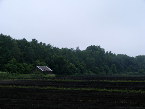
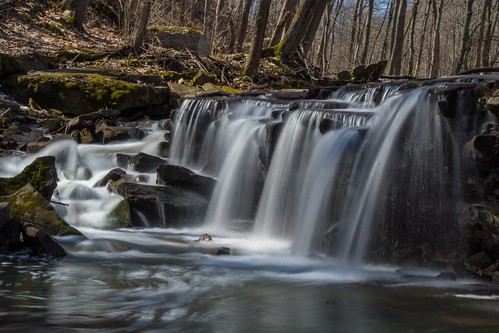
Little Beard's Town was an influential and well-developed town that once existed on the western side of the Genesee River and stood in the area of where Cuylerville, New York is today. The town was named for the found, Little Beard, who was an influential and respected sachem in the late 1700s. The town was known for it's bountiful crops, which included numerous vegetables, large crops/ears of corn, and fruit orchards. The town had well over 100 dwellings, mainly well-built cabins,  that were built around a town square. It and two other nearby Seneca towns were burned down during the Sullivan Expedition in 1779. Altogether, 40 Seneca villages were burned down during this expedition.

The attacks on these villages were, in part, a reaction to the Cherry Valley Massacre, where British soldiers and their Seneca and Mohawk allies attacked the Cherry Valley fort and town. Around 30 citizens were killed and an equal amount were taken into captivity. Along will lower losses and captures of soldiers of the 7th Massachusetts Regiment and militia members.
Incident in Cherry Valley - fate of Jane Wells
By Engraver: Thomas Phillibrown from the original picture by Alonzo Chappel (1828-1887)
[Public domain], via Wikimedia Commons
Read a historical fiction recount of the story of Little Beard's Town. From the book The Scouts of the Valley, by Joseph A. Altsheler, published in 1911. At that link you can also read the whole book or view it on Amazon here.

CHAPTER XXII. LITTLE BEARD'S TOWN

The trumpets called early the next morning, and the five rose, refreshed, ready for new labors. The fires were already lighted, and breakfast was cooking. Savory odors permeated the forest. But as soon as all had eaten, the army marched, going northward and westward, intending to cut through the very center of the Iroquois country. Orders had come from the great commander that the power of the Six Nations, which had been so long such a terrible scourge on the American frontier, must be annihilated. They must be made strangers in their own country. Women and children were not to be molested, but their towns must perish.
As Thayendanegea had said the night before the Battle of the Chemung, the power beyond the seas that had urged the Iroquois to war on the border did not save them. It could not. British and Tories alike had promised them certain victory, and for a while it had seemed that the promises would come true. But the tide had turned, and the Iroquois were fugitives in their own country.
The army continued its march through the wilderness, the scouts in front and heavy parties of riflemen on either flank. There was no chance for a surprise. Henry and his comrades were aware that Indian bands still lurked in the forest, and they had several narrow escapes from the bullets of ambushed foes, but the progress of the army was irresistible. Nothing could check it for a moment, however much the Indian and Tory chiefs might plan.
They camped again that night in the forest, with a thorough ring of sentinels posted against surprise, although there was little danger of the latter, as the enemy could not, for the present at least, bring a sufficient force into the field. But after the moon had risen, the five, with Heemskerk, went ahead through the forest. The Iroquois town of Kanawaholla lay just ahead, and the army would reach it on the morrow. It was the intention of the scouts to see if it was still occupied.
It was near midnight when the little party drew near to Kanawaholla and watched it from the shelter of the forest. Like most other Iroquois towns, it contained wooden houses, and cultivated fields were about it. No smoke rose from any of the chimneys, but the sharp eyes of the scouts saw loaded figures departing through a great field of ripe and waving corn. It was the last of the inhabitants, fleeing with what they could carry. Two or three warriors might have been in that group of fugitives, but the scouts made no attempt to pursue. They could not restrain a little feeling of sympathy and pity, although a just retribution was coming.
"If the Iroquois had only stood neutral at the beginning of the war, as we asked them," said Heemskerk, "how much might have been spared to both sides! Look! Those people are stopping for a moment."
The burdened figures, perhaps a dozen, halted at the far edge of the corn field. Henry and Paul readily imagined that they were taking a last look at their town, and the feeling of pity and sympathy deepened, despite Wyoming, Cherry Valley, and all the rest. But that feeling never extended to the white allies of the Iroquois, whom Thayendanegea characterized in word and in writing as "more savage than the savages themselves."
The scouts waited an hour, and then entered the town. Not a soul was in Kanawaholla. Some of the lighter things had been taken away, but that was all. Most of the houses were in disorder, showing the signs of hasty flight, but the town lay wholly at the mercy of the advancing army. Henry and his comrades withdrew with the news, and the next day, when the troops advanced, Kanawaholla was put to the torch. In an hour it was smoking ruins, and then the crops and fruit trees were destroyed.
Leaving ruin behind, the army continued its march, treading the Iroquois power under foot and laying waste the country. One after another the Indian towns were destroyed, Catherinetown, Kendaia, Kanadesaga, Shenanwaga, Skoiyase, Kanandaigua, Honeyoye, Kanaghsawa, Gathtsewarohare, and others, forming a long roll, bearing the sounding Iroquois names. Villages around Cayuga and other lakes were burned by detachments. The smoke of perishing towns arose everywhere in the Iroquois country, while the Iroquois themselves fled before the advancing army. They sent appeal after appeal for help from those to whom they had given so much help, but none came.
It was now deep autumn, and the nights grew cold. The forests blazed with brilliant colors. The winds blew, leaves rustled and fell. The winter would soon be at hand, and the Iroquois, so proud of what they had achieved, would have to find what shelter they could in the forests or at the British posts on the Canadian frontier. Thayendanegea was destined to come again with bands of red men and white and inflict great loss, but the power of the Six Nations was overthrown forever, after four centuries of victory and glory. Henry, Paul, and the rest were all the time in the thick of it. The army, as the autumn advanced, marched into the Genesee Valley, destroying everything. Henry and Paul, as they lay on their blankets one night, counted fires in three different directions, and every one of the three marked a perishing Indian village. It was not a work in which they took any delight; on the contrary, it often saddened them, but they felt that it had to be done, and they could not shirk the task.
In October, Henry, despite his youth, took command of a body of scouts and riflemen which beat up the ways, and skirmished in advance of the army. It was a democratic little band, everyone saying what he pleased, but yielding in the end to the authority of the leader. They were now far up the Genesee toward the Great Lakes, and Henry formed the plan of advancing ahead of the army on the great Seneca village known variously as the Seneca Castle and Little Beard's Town, after its chief, a full match in cruelty for the older Seneca chief, Hiokatoo. Several causes led to this decision. It was reported that Thayendanegea, Timmendiquas, all the Butlers and Johnsons, and Braxton Wyatt were there. While not likely to be true about all, it was probably true about some of them, and a bold stroke might effect much.
It is probable that Henry had Braxton Wyatt most in mind. The renegade was in his element among the Indians and Tories, and he had developed great abilities as a partisan, being skillfully seconded by the squat Tory, Coleman. His reputation now was equal at least to that of Walter Butler, and he had skirmished more than once with the vanguard of the army. Growing in Henry's heart was a strong desire to match forces with him, and it was quite probable that a swift advance might find him at the Seneca Castle.
The riflemen took up their march on a brisk morning in late autumn. The night had been clear and cold, with a touch of winter in it, and the brilliant colors of the foliage had now turned to a solid brown. Whenever the wind blew, the leaves fell in showers. The sky was a fleecy blue, but over hills, valley, and forest hung a fine misty veil that is the mark of Indian summer. The land was nowhere inhabited. They saw the cabin of neither white man nor Indian. A desolation and a silence, brought by the great struggle, hung over everything. Many discerning eyes among the riflemen noted the beauty and fertility of the country, with its noble forests and rich meadows. At times they caught glimpses of the river, a clear stream sparkling under the sun.
"Makes me think o' some o' the country 'way down thar in Kentucky," said Shif'less Sol, "an' it seems to me I like one about ez well ez t'other. Say, Henry, do you think we'll ever go back home? 'Pears to me that we're always goin' farther an' farther away."
Henry laughed.
"It's because circumstances have taken us by the hand and led us away, Sol," he replied.
"Then," said the shiftless one with a resigned air, "I hope them same circumstances will take me by both hands, an' lead me gently, but strongly, back to a place whar thar is peace an' rest fur a lazy an' tired man like me."
"I think you'll have to endure a lot, until next spring at least," said Henry.
The shiftless one heaved a deep sigh, but his next words were wholly irrelevant.
"S'pose we'll light on that thar Seneca Castle by tomorrow night?" he asked.
"It seems to me that for a lazy and tired man you're extremely anxious for a fight," Henry replied.
"I try to be resigned," said Shif'less Sol. But his eyes were sparkling with the light of battle.
They went into camp that night in a dense forest, with the Seneca Castle about ten miles ahead. Henry was quite sure that the Senecas to whom it belonged had not yet abandoned it, and with the aid of the other tribes might make a stand there. It was more than likely, too, that the Senecas had sharpshooters and sentinels well to the south of their town, and it behooved the riflemen to be extremely careful lest they run into a hornet's nest. Hence they lighted no fires, despite a cold night wind that searched them through until they wrapped themselves in their blankets.
The night settled down thick and dark, and the band lay close in the thickets. Shif'less Sol was within a yard of Henry. He had observed his young leader's face closely that day, and he had a mind of uncommon penetration.
"Henry," he whispered, "you're hopin' that you'll find Braxton Wyatt an' his band at Little Beard's town?"
"That among other things," replied Henry in a similar whisper.
"That first, and the others afterwards," persisted the shiftless one.
"It may be so," admitted Henry.
"I feel the same way you do," said Shif'less Sol. "You see, we've knowed Braxton Wyatt a long time, an' it seems strange that one who started out a boy with you an' Paul could turn so black. An' think uv all the cruel things that he's done an' helped to do. I ain't hidin' my feelin's. I'm jest itchin' to git at him."
"Yes," said Henry, "I'd like for our band to have it out with his."
Henry and Shif'less Sol, and in fact all of the five, slept that night, because Henry wished to be strong and vigorous for the following night, in view of an enterprise that he had in mind. The rosy Dutchman, Heemskerk, was in command of the guard, and he revolved continually about the camp with amazing ease, and with a footstep so light that it made no sound whatever. Now and then he came back in the thicket and looked down at the faces of the sleeping five from Kentucky. "Goot boys," he murmured to himself. "Brave boys, to stay here and help. May they go through all our battles and take no harm. The goot and great God often watches over the brave."
Mynheer Cornelius Heemskerk, native of Holland, but devoted to the new nation of which he had made himself a part, was a devout man, despite a life of danger and hardship. The people of the woods do not lose faith, and he looked up at the dark skies as if he found encouragement there. Then he resumed his circle about the camp. He heard various noises-the hoot of an owl, the long whine of a wolf, and twice the footsteps of deer going down to the river to drink. But the sounds were all natural, made by the animals to which they belonged, and Heemskerk knew it. Once or twice he went farther into the forest, but he found nothing to indicate the presence of a foe, and while he watched thus, and beat up the woods, the night passed, eventless, away.
They went the next day much nearer to the Seneca Castle, and saw sure indications that it was still inhabited, as the Iroquois evidently were not aware of the swift advance of the riflemen. Henry had learned that this was one of the largest and strongest of all the Iroquois towns, containing between a hundred and two hundred wooden houses, and with a population likely to be swollen greatly by fugitives from the Iroquois towns already destroyed. The need of caution—great caution—was borne in upon him, and he paid good heed.
The riflemen sought another covert in the deep forest, now about three miles from Little Beard's Town, and lay there, while Henry, according to his plan, went forth at night with Shif'less Sol and Tom Ross. He was resolved to find out more about this important town, and his enterprise was in full accord with his duties, chief among which was to save the vanguard of the army from ambush.
When the complete darkness of night had come, the three left the covert, and, after traveling a short distance through the forest, turned in toward the river. As the town lay on or near the river, Henry thought they might see some signs of Indian life on the stream, and from this they could proceed to discoveries.
But when they first saw the river it was desolate. Not a canoe was moving on its surface, and the three, keeping well in the undergrowth, followed the bank toward the town. But the forest soon ceased, and they came upon a great field, where the Senecas had raised corn, and where stalks, stripped of their ears and browned by the autumn cold, were still standing. But all the work of planting, tending, and reaping this great field, like all the other work in all the Iroquois fields, had been done by the Iroquois women, not by the warriors.
Beyond the field they saw fruit trees, and beyond these, faint lines of smoke, indicating the position of the great Seneca Castle. The dry cornstalks rustled mournfully as the wind blew across the field.
"The stalks will make a little shelter," said Henry, "and we must cross the field. We want to keep near the river."
"Lead on," said Shif'less Sol.
They took a diagonal course, walking swiftly among the stalks and bearing back toward the river. They crossed the field without being observed, and came into a thick fringe of trees and undergrowth along the river. They moved cautiously in this shelter for a rod or two, and then the three, without word from any one of them, stopped simultaneously. They heard in the water the unmistakable ripple made by a paddle, and then the sound of several more. They crept to the edge of the bank and crouched down among the bushes. Then they saw a singular procession.
A half-dozen Iroquois canoes were moving slowly up the stream. They were in single file, and the first canoe was the largest. But the aspect of the little fleet was wholly different from that of an ordinary group of Iroquois war canoes. It was dark, somber, and funereal, and in every canoe, between the feet of the paddlers, lay a figure, stiff and impassive, the body of a chief slain in battle. It had all the appearance of a funeral procession, but the eyes of the three, as they roved over it, fastened on a figure in the first canoe, and, used as they were to the strange and curious, every one of them gave a start.
The figure was that of a woman, a wild and terrible creature, who half sat, half crouched in the canoe, looking steadily downward. Her long black hair fell in disordered masses from her uncovered head. She wore a brilliant red dress with savage adornments, but it was stained and torn. The woman's whole attitude expressed grief, anger, and despair.
"Queen Esther!" whispered Henry. The other two nodded.
So horrifying had been the impression made upon him by this woman at Wyoming that he could not feel any pity for her now. The picture of the great war tomahawk cleaving the heads of bound prisoners was still too vivid. She had several sons, one or two of whom were slain in battle with the colonists, and the body that lay in the boat may have been one of them. Henry always believed that it was-but he still felt no pity.
As the file came nearer they heard her chanting a low song, and now she raised her face and tore at her black hair.
"They're goin' to land," whispered Shif'less Sol.
The head of the file was turned toward the shore, and, as it approached, a group of warriors, led by Little Beard, the Seneca chief, appeared among the trees, coming forward to meet them. The three in their covert crouched closer, interested so intensely that they were prepared to brave the danger in order to remain. But the absorption of the Iroquois in what they were about to do favored the three scouts.
As the canoes touched the bank, Catharine Montour rose from her crouching position and uttered a long, piercing wail, so full of grief, rage, and despair that the three in the bushes shuddered. It was fiercer than the cry of a wolf, and it came back from the dark forest in terrifying echoes.
"It's not a woman, but a fiend," whispered Henry; and, as before, his comrades nodded in assent.
The woman stood erect, a tall and stalwart figure, but the beauty that had once caused her to be received in colonial capitals was long since gone. Her white half of blood had been submerged years ago in her Indian half, and there was nothing now about her to remind one of civilization or of the French Governor General of Canada who was said to have been her father.
The Iroquois stood respectfully before her. It was evident that she had lost none of her power among the Six Nations, a power proceeding partly from her force and partly from superstition. As the bodies were brought ashore, one by one, and laid upon the ground, she uttered the long wailing cry again and again, and the others repeated it in a sort of chorus.
When the bodies-and Henry was sure that they must all be those of chiefs-were laid out, she tore her hair, sank down upon the ground, and began a chant, which Tom Ross was afterwards able to interpret roughly to the others. She sang:
The white men have come with the cannon and bayonet,
Numerous as forest leaves the army has come.
Our warriors are driven like deer by the hunter,
Fallen is the League of the Ho-de-no-sau-nee!

Our towns are burned and our fields uprooted,
Our people flee through the forest for their lives,
The king who promised to help us comes not.
Fallen is the League of the Ho-de-no-sau-nee!

The great chiefs are slain and their bodies lie here.
No longer will they lead the warriors in battle;
No more will they drive the foe from the thicket.
Fallen is the League of the Ho-de-no-sau-nee!

Scalps we have taken from all who hated us;
None, but feared us in the days of our glory.
But the cannon and bayonet have taken our country;
Fallen is the League of the Ho-de-no-sau-nee!
She chanted many verses, but these were all that Tom Ross could ever remember or translate. But every verse ended with the melancholy refrain: "Fallen is the League of the Ho-de-no-sau-nee!" which the others also repeated in chorus. Then the warriors lifted up the bodies, and they moved in procession toward the town. The three watched them, but they did not rise until the funeral train had reached the fruit trees. Then they stood up, looked at one another, and breathed sighs of relief.
"I don't care ef I never see that woman ag'in," said Shif'less Sol. "She gives me the creeps. She must be a witch huntin' for blood. She is shore to stir up the Iroquois in this town."
"That's true," said Henry, "but I mean to go nearer."
"Wa'al," said Tom Ross, "I reckon that if you mean it we mean it, too."
"There are certainly Tories in the town," said Henry, "and if we are seen we can probably pass for them. I'm bound to find out what's here."
"Still huntin' fur Braxton Wyatt," said Shif'less Sol.
"I mean to know if he's here," said Henry.
"Lead on," said the shiftless one.
They followed in the path of the procession, which was now out of sight, and entered the orchard. From that point they saw the houses and great numbers of Indians, including squaws and children, gathered in the open spaces, where the funeral train was passing. Queen Esther still stalked at its head, but her chant was now taken up by many scores of voices, and the volume of sound penetrated far in the night. Henry yet relied upon the absorption of the Iroquois in this ceremonial to give him a chance for a good look through the town, and he and his comrades advanced with boldness.
They passed by many of the houses, all empty, as their occupants had gone to join in the funeral lament, but they soon saw white men-a few of the Royal Greens, and some of the Rangers, and other Tories, who were dressed much like Henry and his comrades. One of them spoke to Shif'less Sol, who nodded carelessly and passed by. The Tory seemed satisfied and went his way.
"Takes us fur some o' the crowd that's come runnin' in here ahead o' the army," said the shiftless one.
Henry was noting with a careful eye the condition of the town. He saw that no preparations for defense had been made, and there was no evidence that any would be made. All was confusion and despair. Already some of the squaws were fleeing, carrying heavy burdens. The three coupled caution with boldness. If they met a Tory they merely exchanged a word or two, and passed swiftly on. Henry, although he had seen enough to know that the army could advance without hesitation, still pursued the quest. Shif'less Sol was right. At the bottom of Henry's heart was a desire to know whether Braxton Wyatt was in Little Beard's Town, a desire soon satisfied, as they reached the great Council House, turned a corner of it, and met the renegade face to face.
Wyatt was with his lieutenant, the squat Tory, Coleman, and he uttered a cry when he saw the tall figure of the great youth. There was no light but that of the moon, but he knew his foe in an instant.
"Henry Ware!" he cried, and snatched his pistol from his belt.
They were so close together that Henry did not have time to use a weapon. Instinctively he struck out with his fist, catching Wyatt on the jaw, and sending him down as if he had been shot. Shif'less Sol and Tom Ross ran bodily over Coleman, hurling him down, and leaping across his prostrate figure. Then they ran their utmost, knowing that their lives depended on speed and skill.
They quickly put the Council House between them and their pursuers, and darted away among the houses. Braxton Wyatt was stunned, but he speedily regained his wits and his feet.
"It was the fellow Ware, spying among us again!" he cried to his lieutenant, who, half dazed, was also struggling up. "Come, men! After them! After them!"
A dozen men came at his call, and, led by the renegade, they began a search among the houses. But it was hard to find the fugitives. The light was not good, many flitting figures were about, and the frantic search developed confusion. Other Tories were often mistaken for the three scouts, and were overhauled, much to their disgust and that of the overhaulers. Iroquois, drawn from the funeral ceremony, began to join in the hunt, but Wyatt could give them little information. He had merely seen an enemy, and then the enemy had gone. It was quite certain that this enemy, or, rather, three of them, was still in the town.
Henry and his comrades were crafty. Trained by ambush and escape, flight and pursuit, they practiced many wiles to deceive their pursuers. When Wyatt and Coleman were hurled down they ran around the Council House, a large and solid structure, and, finding a door on the opposite side and no one there or in sight from that point, they entered it, closing the door behind them.
They stood in almost complete darkness, although at length they made out the log wall of the great, single room which constituted the Council House. After that, with more accustomed eyes, they saw on the wall arms, pipes, wampum, and hideous trophies, some with long hair and some with short. The hair was usually blonde, and most of the scalps had been stretched tight over little hoops. Henry clenched his fist in the darkness.
"Mebbe we're walkin' into a trap here," said Shif'less Sol.
"I don't think so," said Henry. "At any rate they'd find us if we were rushing about the village. Here we at least have a chance."
At the far end of the Council House hung mats, woven of rushes, and the three sat down behind them in the very heart of the Iroquois sanctuary. Should anyone casually enter the Council House they would still be hidden. They sat in Turkish fashion on the floor, close together and with their rifles lying across their knees. A thin light filtered through a window and threw pallid streaks on the floor, which they could see when they peeped around the edge of the mats. But outside they heard very clearly the clamor of the hunt as it swung to and fro in the village. Shif'less Sol chuckled. It was very low, but it was a chuckle, nevertheless, and the others heard.
"It's sorter takin' an advantage uv 'em," said the shiftless one, "layin' here in thar own church, so to speak, while they're ragin' an' tearin' up the earth everywhar else lookin' fur us. Gives me a mighty snug feelin', though, like the one you have when you're safe in a big log house, an' the wind an' the hail an' the snow are beatin' outside."
"You're shorely right, Sol," said Tom Ross.
"Seems to me," continued the irrepressible Sol, "that you did git in a good lick at Braxton Wyatt, after all. Ain't he unhappy now, bitin' his fingers an' pawin' the earth an' findin' nothin'? I feel real sorry, I do, fur Braxton. It's hard fur a nice young feller to have to suffer sech disappointments."
Shif'less Sol chuckled again, and Henry was forced to smile in the darkness. Shif'less Sol was not wholly wrong. It would be a bitter blow to Braxton Wyatt. Moreover, it was pleasant where they sat. A hard floor was soft to them, and as they leaned against the wall they could relax and rest.
"What will our fellows out thar in the woods think?" asked Tom Ross.
"They won't have to think," replied Henry. "They'll sit quiet as we're doing and wait."
The noise of the hunt went on for a long time outside. War whoops came from different points of the village. There were shrill cries of women and children, and the sound of many running feet. After a while it began to sink, and soon after that they heard no more noises than those of people preparing for flight. Henry felt sure that the town would be abandoned on the morrow, but his desire to come to close quarters with Braxton Wyatt was as strong as ever. It was certain that the army could not overtake Wyatt's band, but he might match his own against it. He was thinking of making the attempt to steal from the place when, to their great amazement, they heard the door of the Council House open and shut, and then footsteps inside.
Henry looked under the edge of the hanging mat and saw two dusky figures near the window.
thumbnail

Dogpatch USA "Abandoned Hillbilly Amusement Park" in Marble Falls, Arkansas

Dogpatch USA theme park, which operated from 1968 to 1993, holds a unique place in amusement park history as it was based on the iconic Li'l Abner comic strip created by Al Capp. Nestled in the picturesque surroundings of Marble Falls, Arkansas, Dogpatch USA garnered fame not only for its recreational offerings but also for its scenic beauty that attracted tourists from far and wide.

At the heart of Dogpatch USA was a meticulously crafted replica of the fictional town of Dogpatch, as depicted in the Li'l Abner comic strip. This immersive experience allowed visitors to meander through the charming streets and interact with characters straight out of the beloved strip. The park's attention to detail extended beyond the town itself, featuring a trout farm, a museum showcasing memorabilia from the comic strip, and a variety of other attractions that delighted guests of all ages.

One of the notable highlights of Dogpatch USA was the Dogpatch Express, a train that traversed the sprawling park, offering visitors a leisurely ride while they soaked in the enchanting atmosphere. This train journey provided a unique vantage point to admire the beauty of the park's surroundings, enhancing the overall experience for guests.

In its early years, Dogpatch USA experienced resounding success, drawing crowds and establishing itself as a premier amusement park. Such was its popularity that, at one point, the town of Marble Falls even changed its name to Dogpatch to align itself with the park's theme and to further promote the destination.

Sadly, despite its initial triumph, Dogpatch USA faced financial struggles that ultimately led to its closure in 1993. Several factors contributed to the park's decline, including increased competition from other regional amusement parks and the economic downturn of the early 1990s. Despite efforts to keep the park afloat, these challenges proved insurmountable, forcing Dogpatch USA to cease operations.

Following the closure of the park, the town of Marble Falls reverted to its original name, bidding farewell to the Dogpatch era. For many years, Dogpatch USA lay abandoned, its once-thriving streets now echoing with memories of the past. In 2006, a significant portion of the park was demolished, marking the end of an era.

While the physical remnants of Dogpatch USA may have faded over time, its impact on the world of theme parks and the nostalgia it evokes in those who visited during its heyday remain strong. The park's dedication to bringing a beloved comic strip to life created a unique and enchanting experience that captured the imaginations of visitors. Dogpatch USA holds a cherished place in the hearts of those who experienced its magic, serving as a testament to the power of storytelling and the enduring allure of amusement parks.
Marble Falls Nature Park: DOGPATCH USA | Exciting news about Johnny Morris' new nature park

News Segment about Dogpatch USA - 5NEWS Vault | Dogpatch USA (1988):


1971 Home video taken at Dogpatch USA:

thumbnail

Massasoit - Great Sachem of the Wampanoag Confederacy

Massasoit statue plymouth 2007
By Gkullberg (Own work) [CC BY-SA 3.0
or GFDL], via Wikimedia Commons
Massasoit
, Osamequin, Yellow Feather, son of Wasanegin, was a member, and leader, of the Pokanoket (People of the First Light). It was his humanity and acts that aided the newly-arrived pilgrims at Plymouth to survive winter and the plantation's hardships of the following years. He had many negotiations and dealings with Plymouth and colonial leaders, including William Bradford, John Carver, Stephen Hopkins, Edward Winslow, and Myles Standish. A peace treaty, made on March 22nd, 1621, created an alliance that guaranteed peace between the Wampanoag and Plymouth, under Massasoit's word.

This treaty also had the Wampanoag remaining as neutrals during the Pequot War. His word and dealings, with the Plymouth Colony, kept a sometimes unstable peace between the Colony and the Wampanoag for nearly half a century. It was a peace that also died along with Massasoit's death around the year 1661.

Born: (circa) 1580 near Sowans, Mount Hope, Rhode Island
Died: (circa) 1661 Sowans, Mount Hope, Bristol, Rhode Island

Learn More at:
http://mayflowerhistory.com/massasoit/
https://web.archive.org/web/20160410185739/http://mayflowerfamilies.com/?page_id=1818#P139
thumbnail

Rollin T. Grant Gulf Wilderness Park in Lockport, NY

The Rollin T. Grant Gulf Wilderness Park is a rare jewel of nature in the northwest corner of the city of Lockport! Here is New York State's only full nature preserve on the Niagara Escarpment. The Niagara Frontier's premier destination for flora, fossils, wildlife, and rock study... In a true wilderness environment!

Indian Falls Gulf Wilderness Park


Features Indian Falls and numerous other natural sights.

The Rollin T. Grant Gulf Wilderness Park is a true, unspoiled wilderness. (Photo of sign at https://goo.gl/maps/4S67BVagrxP2) There are trails but little other accommodations of the modern life. The location is on the south side of West Jackson Street (near the 5900 block) where there is limited auto parking. Within the park is a millstone originally used in a 19th Century paper mill on the north side of the Erie Barge Canal in Lockport (at the present location of Upson Park). It was transported to this site in 1972 with a plaque attached to it to recognize the donation of seven acres at the park entry by the family of Josephine McCollum Carveth. The poem on the plaque reminds us to look here for English violets in early to mid April.

Map sign at the Park: https://goo.gl/maps/eowjXYDCVJF2

Overview and History

The Gulf Wilderness Park is a wooded ravine which was first cut out by a once raging river whose waters came from glacial melt during a warming cycle ten to fifteen thousand years ago. The glacier was formed during the latest of four glacial periods that covered much of North America and New York State two to three million years ago with ice sheets a mile or so thick.

The melting ice left vast bodies of water in the lowland. Glacial Lake Iroquois, the larger predecessor of Lake Ontario, was one. Its beaches are today represented by the plateau to the north of the escarpment here at Lockport.  In fact, U.S. Route 104 is built on the old beach ridge.

Glacial Lake Tonawanda lay to the south of Lockport between the Niagara Escarpment (goes through and divides Lockport) and the Onondaga Escarpment (which lies generally along Route 5 from the Buffalo city line through Amherst and Clarence--most dramatically noticed on Transit Road, heading north just past today's Eastern Hills Mall). The level plain between Lockport and Buffalo represents the bottom of Lake Tonawanda, with Tonawanda Creek being the remnant of the deepest part. Bear Ridge and Beach Ridge Roads were built along northerly dunes of the old lake.

Lake Tonawanda drained north into Lake Iroquois through outlet streams whose spillways eroded gorges through dolostone, shale, limestone, and sandstone strata.  The largest spillway was at Lewiston on the Niagara River (which eventually migrated south, developing into Niagara Falls). The second-largest spillway was here at Lockport and the Gulf Ravine is the exact location of this spillway. The third largest spillway out of the lake was near the present Cold Springs Road and the Lockport Town & Country Club golf course. There were lesser spillways to the east, including Gasport's Royalton Ravine and yet another just east of Medina. There was a slight west tilt to which favored more lake water going to the west.

As the level of Glacial Lake Tonawanda fell, flow of the outlets ceased except for local drainage and the Niagara River at Niagara Falls. With a greater initial flow the spillway at Lewiston-Niagara Falls cut more rapidly down the cap rock than falls at Lockport and points east. Finally when Lake Tonawanda fell below the level of the spillways at Lockport and points east, the falls here just dried up. Niagara Falls became the only outlet for the remains of Lake Tonawanda and for the output of the other Great Lakes.

The Alabama and Oak Orchard Swamps to the east and south of Lockport, and the overflowing ditches and creeks along roads in Amherst and Tonawanda during spring thaws are evidence that "old Lake Tonawanda" may not be completely drained yet. The West Branch of 18-Mile Creek, flowing through our Gulf Park, is all that remains of an ancient torrential stream.


Rocks and Fossils

Gulf Wilderness Park is an excellent location to study rock and formations and search for fossils.

Proof of the age of rock strata in Gulf Wilderness Park is found in the red sandstone surfaces of the Grimsby sandstone, where structures like intertwined ropes ("Arthrophycus") represent the fossil remains of worm burrows from the Silurian Period of about 430 million years ago. Fossils are also found in other rock layers in this park. One can look for crinoids, brachiopods, and corals.

Just east of the park property, along West Jackson Street, you can encounter an excellent display or two major rock formations being cut through in this area and notice the different weathering effect on each. The top layer is the "Medina group" of sandstone, while layers of (red) shale below it are of the Queenston group. As the shale begins to crumble it takes a course of turning into stone debris and eventually clay. The results can be easily seen at this location.

This stone display is equivalent to what you'd find through the Gulf ravine. At the bottom of the ravine, where most of the nature trails are routed, you'll find Grimsby sandstone formations and limestone.

John Keryk, who has explored this area intensively over the years advises fossil hunters, "Park near or at where the nature park is off West Jackson Street and head up-stream. The outcrops best are near stream level. Can also park by RR tracks. That used to be a good area for weathered fossils from the Clinton formation (at least until they re-graded the RR right of way). Still, west side of tracks one can find good examples of Clinton formation lying on the ground." See the map at the bottom of this page.

Wildflowers

The display of wildflowers and plants found in the park is unsurpassed in the area.  Spring, of course, is the best time to be looking for flowers. First come beautiful English violets. Also early are bloodroot, hepatica, and trillium. Later comes wild mint, leeks; then wild roses, jewelweed and doll's-eyes. Ferns are evident most of the year. In addition to the flowers, a wide variety of trees are found here.

Trees, Shrubs, & Vines

A wide variety of trees typical of the northeastern hardwood forest is found in Gulf Wilderness Park. Essential to the Gulf's life cycle are the many dead and dying trees. Birds, mammals, amphibians and reptiles are dependent in various ways on "snags" or standing dead trees. They are used for nesting, courting, mating, hibernating and as rich sources for foraging insects. Equally important are fallen logs that are essential for feeding, reproduction and protection. Fungi, algae and mosses thrive on the decaying wood.

Map Of Gulf Wilderness Park

Although you may enter Wilderness Park off of Niagara Street, near the railroad where the "parking" area is indicated on the map, the preferred entry for most will be off West Jackson Street. There are four separate nature trails through the park which are color-coded on a map at the entry points. The trails have no special individual significance except as reference points.


We are a participant in the Amazon Services LLC Associates Program, an affiliate advertising program designed to provide a means for us to earn fees by linking to Amazon.com and affiliated sites.
As an Amazon Associate I earn from qualifying purchases.
As an eBay Partner, I may be compensated if you make a purchase through eBay links on this site

Some articles on this blog may include AI-generated elements. While we strive for accuracy and relevance, please note that AI-assisted content may not always reflect the most current information. We recommend verifying important details independently to ensure accuracy

Subscribe for Updates: