November 2016

Muscatatuck National Wildlife Refuge in Indiana

Friday, November 25, 2016
Muscatatuck National Wildlife Refuge in Indiana
The Muscatatuck National Wildlife Refuge is comprised of 7,802-acres. Founded in 1966, it became the state of Indiana's first wildlife refuge. The refuge takes its name from the nearby Muscatatuck River. In English, Muscatatuck means, "The Land of the Winding Waters". The refuge is not far from Seymour, in Southeastern Indiana. It spans across parts of three counties in the State of Indiana. Like many wildlife refuges, its creation was funded by Duck Stamps.

By The original uploader was Bedford at English Wikipedia [Copyrighted free use], via Wikimedia Commons


Audubon Guide to the National Wildlife Refuges

When visiting the park, it is best to be prepared beforehand. While hiking through certain parts of the refuge, you will want to wear long-sleeved shirts and pants to protect yourself from ticks and biting flies. Informational reading materials, with maps and refuge details, are available at the visitor center. Notices will also be available during the hunting season.

Wildlife of the Muscatatuck National Wildlife Refuge

Both wood ducks and bald eagles have nesting areas at the wildlife refuge. The bald eagles have a small but growing population at Muscatatuck. Each year they produce offspring and have been in the area for over a decade. They hunt fish from the marshes and other areas of the refuge. As for wood ducks, they're plentiful during the warmer seasons. The male ducks arrive in February in search of nesting places. The females arrive not long after and begin laying eggs in the nests in March and April. The nests are usually built inside tree spaces and cavities. They do so to protect the nests from the wind, other elements, and any predators. Once May comes around, the baby wood ducks begin to hatch. They spend the summer out of the nest and migrate with the rest of the ducks in late Autumn. On the refuge are great blue herons and many species of small birds.

River otters make up another noticeable population of wildlife on the refuge. They've seen their numbers dwindle around the state in the past due to hunting and habitat loss. In 1995, they were reintroduced at Muscatatuck. Which was the first ever reintroduction effort of river otters in Indiana. If you look to watch wildlife then it's best to visit in the morning around sunrise.

By Nyttend (Own work) [Public domain], via Wikimedia Commons

Land Features of the Muscatatuck National Wildlife Refuge

Grasslands

The grasslands of Muscatatuck are maintained through mowing and burning of the grass. This is for the prevention of tree growth and overgrowth. Which allows wildlife to thrive better in the grassland areas. Along the trail areas, it is the grasslands that provide opportunities to spot wildlife.

Wetlands

Historically, Indiana had plenty of wetlands. Though, many were drained to make way for farmland by settlers. The drainage of much the area of Muscatatuck was unsuccessful though. In time, some of this former farmland has been developed further. Which includes the areas around Muscatatuck. The wildlife refuge has just one of the many wetland preserves across Indiana.

The water levels in the marshes, lakes and elsewhere on the refuge are maintained by refuge staff. Which includes flooding and draining some of the wetlands to keep the grounds healthy. This is done by pipes and water controls connecting sections of the wetlands. The water is moved routinely throughout the year. Which includes the marshy lower lands of the refuge that are filled in autumn and drained in the spring. The same thing occurs at the lowland forests. This is to aid waterfowl and, more specifically, the wood ducks. Two of these marshes are named the Endicott and MacDonald Marshes.

Forest Areas

Around 55% of the Muscatatuck refuge consists of forest. Of that, approximately 57% of the forest is bottomland hardwood forest and 43% is an upland forest. The rest of the land area is a mix of habitats, including those listed above. Workers at the refuge remove beaver dams to keep these bottomland forest areas healthy. In select areas of the refuge, trees are planted to provide for the wildlife and keep the forest continuous.


Muscatatuck National Wildlife Refuge Hiking Trails

Muscatatuck has eight hiking trails ranging from 0.2 miles to 4 miles in length. The trails range from easy to moderate 'difficulty' for hikers. The trails near the river sometimes flood and will be impassable if flooding occurs.

Bird Trail (0.7 Miles)

Consists mostly of hardwood forest with some cedar forest make up the trail. Many birds, from songbirds and larger species of birds, are present here.

Chestnut Ridge (0.4 Miles)

This trail begins not far from the visitor center. It is wheelchair accessible and has benches along the trail. The trail consists of areas which send you through dense forest. You'll also pass a small lake where wood ducks, turtles, and other wildlife is sometimes seen.

East River Trail (3 Miles)

The East River Trail is located further south in the refuge. Parking is available at Persimmon Ponds. Along the trail, you'll come across the old pioneer cemetery and open meadowland.

Endicott Trail (0.2 Miles)

A short trail along the auto tour route. This is a route, also accessible by vehicle, that has an overlook at one of the refuge's lakes. Marshland, meadows, and forest make up this trail.

Richart Lake Trail (0.9 Miles)

The lake that this trail gets its name from is one of the large lakes at Muscatatuck. Along this trail is the Hackman Overlook, where you'll be able to spot plenty of waterfowl.

Turkey Trail (1 Mile)

Also near the auto tour route, this trail has hardwood wetlands and is another wood duck habitat. Also present are turkeys and sometimes other random wildlife.

West River Trail (4 Miles)

The West River Trail is located along more of the river than the East River Trail. Along this route, you'll find Myers' Cabin and Myers' Barn. Both of which were built around 1900. In the spring, the area is covered with wildflowers.

Wood Duck Trail (0.5 Miles)

Here you'll head through dense forest comprised of hardwood trees. If you head down the auto road you'll be able to view Stanfield Lake.


Links:


Gabrielle Aplin - Miss You (Official Music Video)

Wednesday, November 23, 2016
Gabrielle Aplin - Miss You (Official Music Video)

I can't think of its name right now but this video of Gabrielle Aplin's song Miss You reminds me of a specific late 70s movie i saw. I know, what film it resembles is probably really obvious to some but i'm drawing a blank. In parts, her look reminds of Kristy's McNichol's fierce character Amanda Child in the 1981 film, "The Night the Lights Went Out In Georgia".

All in all, i enjoy the uniqueness, the colorfulness, and the lightheartedness of this music video.

Summary:
Hope you enjoy the video for "Miss You"! For this video I wanted to explore how we recall and remember certain events and memories in life. This video is a visual depiction of how our minds can alter memories into something slightly different each time we think of them.
Video directed by: Stephen Agnew
Produced by: Jamie Whymark, Kode Media
Art Director: Dale Slater

Hair: Johnnie Biles
MUA: Crystabel Riley
Styling: Zoe Graham

Spring Ranch, Nebraska and The Haunted Bridge - Nebraska Ghost Stories

Friday, November 18, 2016
Spring Ranch, Nebraska and The Haunted Bridge - Nebraska Ghost Stories

Spring Ranch - History of the Town and the Hanging

Spring Ranch, in Nebraska, more than likely received its name from the numerous springs in the area of the town. Spring Ranch's post office was established on December 14th, 1870 and stayed in operation until the year 1940. It was in 1910 when the town of Spring Ranch reached its highest population of 57 residents. During its years in existence, Spring Ranch was a stagecoach stop on the Overland Trail and the town was located on the north side of the Little Blue River. The Overland Trail being a section of the larger Oregon Trail. It was also Stop #9 of the Pony Express in the state of Nebraska.'


Besides being a stop for many travelers, it was also a farming and ranching town in its heyday. Today, there are still some buildings, mainly remnants of buildings, standing on the grounds which were once Spring Ranch. Some of the ruins include an old train depot and there's a historical marker for the former town on Highway 74 and a bit north of the old town site.

Directions to Spring Ranch

To get to Spring Ranch, you can start out in Hastings or Aurora (if visiting Kronborg and Witch's grave). From Hastings, take Highway 281 south about 10 miles to Highway 74. Take Highway 74 east (left turn) about 6 to 8 miles. When you cross into Clay county, it's just 2 miles into the county. When you get to the county road two miles in, take a right and go 1 1/2 to 2 miles to Spring Ranch. If you go a very short distance further east on Highway 74, you will see the historical marker telling the story of Spring Ranch.
   
If you come from Aurora, take Highway 14 south 6 miles past Clay Center to Highway 74 (about 33 miles to Highway 74). Take a right at Highway 74 and head west. It's approximately 10 to 12 miles to the historical marker on the south side of the highway (your left). At the next gravel road, past the marker, take a left and go 1 1/2 to 2 miles south to Spring Ranch. The haunted bridge is just a 1/4 mile south of the town's site.

Tale of the Haunted Bridge in Spring Ranch, Nebraska

In 1885, two of Spring Ranch's townspeople, Tom Jones and his sister Elizabeth Taylor (widowed), were at odds with their neighbors. This was due to their cattle getting into other neighbor's wheat and cornfields. This and a few other things had caused simmering tensions for quite some time. Most of their neighbors couldn't tolerate them anymore. Consequently, Tom and Elizabeth also started to not feel safe. So, they bought a shotgun. They were the only ones in town with a shotgun (others had rifles).  
     
One day a wagon of a few men were down on the Little Blue River cutting timber. Elizabeth claimed the land was hers, and sent her hired ranch hands to chase them down. All of a sudden, someone heard a shot, and Elizabeth was seen running toward her house. One of the wagon drivers was dead, with half his head missing (obviously from a shotgun blast).  

It would be many months before a judge would be by to conduct a trial, so the townspeople took justice into their own hands. They snuck into her house while she was away and took her shotgun. They came back later to get her and her brother, they wouldn't be able to shoot at them with no gun. They were captured and their hands were tied behind their backs. They were marched down toward the river, where hangman's nooses were hung from the bridge over the Little Blue River. They were put on horses on a sandbar in the river. The nooses were tightened around their necks, and a gun was fired to scare the horses. The horses took off and left Tom and Elizabeth hanging to die. Some say that the gun that was fired was Elizabeth's shotgun.  

Elizabeth was the only woman to ever be lynched in Nebraska. There is still a bridge over the Little Blue River in this same spot (just south of the town's site). It's old, but probably not all original.  The bridge is said to be haunted by their ghosts. If you're out on silent night on that Nebraska prairie, it is said you can hear some of the events that played out on and under the bridge that fateful day in 1885.


Related: 


Long Walk of the Navajo - Facts and Timeline Documentary

Monday, November 14, 2016
Long Walk of the Navajo - Facts and Timeline Documentary
The Long Walk of the Navajo was a forced relocation of the Navajo people from Eastern Arizona to the area of Fort Sumner in New Mexico. The forced march was an act carried out under the command of the federal government. All together, there were 53 occurrences of forced marches that happened between August of 1864 and until late 1866. Over 200 individuals died while marching to New Mexico.


Burnsville, Minnesota Native American History and Burial Mounds

Thursday, November 10, 2016
Burnsville, Minnesota Native American History and Burial Mounds
Early Lake in Burnsville,  Minnesota
Before the arrival of the white man, Native Americans had thriving cultures that much of the world had never seen. Regarding the burial mounds that were seen by the arriving people, the lack of artifacts in some burial mounds was thought to indicate ancient burial grounds. Since the early Native Americans had insufficient tools for digging graves in the frozen earth, they devised an alternative of securing the dead bodies to scaffolding high above the ground so that wild animals could not get to them. In the spring, mass burial took place. Shallow graves were made by scraping the earth off to the sides of the bodies as the bodies were interred. With primitive tools they were covered and sometimes surrounded with post fences, which in turn decayed making the mound higher. It was important to the Indians to choose elevated places (pahas) for the burials so they could be seen soon after.

The History of Dakota and Goodhue Counties states that there are mounds on the west side of the Credit River between Savage and Minnesota River. It's possible that these were the graves of Good Road's village which was at the mouth of Nine Mile Creek on the Bloomington side of the river. It is known that Good Road's village also inhabited the south side of the Minnesota River opposite Nine mile Creek. It is believed there were mounds fifty feet above Crystal Lake on the north shore, as well as seven mounds on the east shore of Early Lake, which would have been the area of the Walsh homestead southeast of the Dakota County Library.

There are three known Indian grounds in Burnsville. The one unearthed in River Hills must have been very old because there were no artifacts found. The one unearthed in 1943 on the Tom Kenneally farm yielded four graves of more recent origin. /the field reports of this discovery said it indicated some sort of Christian burial. Apparently each body was buried in a wooden box with glass panes. Objects found with the bones were glass beads (trade items with white traders), steel scissors wrapped in a quantity of red cloth, a copper object (indicating trade with the Michigan area), a catlinite pipe, a long ornament of the type worn in breast plates, umbrella ribs inserted in copper sockets. Glass beads were found around the neck and the clavicle area, three open rings of trade brass on one forearm, and black hair which had been preserved under a copper clasp. It is certain that this burial took place between 1834 and 1856 when the Pond brothers made wooden coffins for their Indian friends. In 1856 all of Black Dog's village was moved to the reservation near Morton, Minnesota.

The third burial site is Teepee Hill located south of a bluff east of the Credit River. When gravel was taken from the pit in that area for the road to Archie McColl's home, Indian remains were found. Before St. John's cemetery was consecrated, some white settlers were buried in the Indian burial mound.

Black Dog's village was on the isthmus of land between Black Dog Lake and the Minnesota River, the present site of the Black Dog Power Plant. There were perhaps as many as 250 Indians living there when the first white man came. Black Dog's people belonged to the Mdewankanton band of the Sioux, also known as the Dakota Indians. It is believed that this band moved from the Mille Lacs area around 1750. This piece of land appeared to be a wise choice since it provided water for drinking, travel, fish, water fowl, and other game animals. Black Dog's band was often referred to as "the people who didn't eat geese", because they found such a good market for geese at Fort Snelling. They also found a ready market for fish caught in Black Dog Lake among the Irish roman Catholic settlers who were the first Europeans to settle in the area. They were most anxious to trade the fish for fresh pork which was a staple among the Irish.

Indian Trails well worn from this village south toward the Red Wing village at the mouth of the Cannon on the Mississippi River and west to Good Road's village at the mouth of Bloomington's Nine Mile Creek. The trail continued to Shakpay's village from which Shakopee derives its name.

Catlin, the fine painter of the early 1800's said Black Dog, sometimes called Big Eagle, was an old man when he painted his picture in 1834. This picture hangs in the Smithsonian Institute. Undoubtedly the stone from which peace pipes were made was called catlinite because of associations with the painter, Catlin. Old Black Dog became a grandfather when little Black Dog bas born in 1827 to Grey Iron, sometimes called "My Headaches".

Indian treaties dealing with Minnesota are on display in the Archives in Washington D.C. However, the treaty with Zebulon Pike, giving nine square miles at the mouth of the Minnesota River for the building of Fort Snelling was not officially recorded. Part of this is in Eagan Township. It is interesting to note that the Prairie du Chien treaty of 1825 was signed by Black Dog, Good Road, Shakpay, and Eagle Head. It is possible that Eagle Head, whose name so often appears on treaties, resided near the mounds on Teepee Hill. By 1836 Grey Iron was the chief because he signed the Mendota Treaty along with Big Eagle and Good Road whereby the Indians relinquished the land north of the Missouri River to the southern part of Minnesota. Perhaps the most important treaties were made in 1851. In July, at Traverse des Sioux on the Minnesota River near St. Peter, the land east of Red River was relinquished, signed by Grey Iron with Governor Ramsey, Luke Lea, and General Le Duc in attendance.

Another treaty was signed in 1852 which amended the original, and was signed at the Sibley House. It said that the Indians could be moved in detachments in 1852. No wonder Grey Iron came to be called "My Headaches". He died in 1857, five years after the signing away of their very subsistence for 12 cents an acre for a total of $3,520,000 to be held in trust by the government. It seemed like a fair amount of money at that time, but most of the cash was designated to pay for farm implements, teachers, especially to teach farming, schools, and even to pay excessive claims of the traders for debts of Indians long dead. No wonder the Indians were disgruntled.

Hazen Mooers, who was married to an Indian, was hired to teach Black Dog's village farming. When the band moved out, Hazen's son-in-law, J.W. Brown, moved in and preempted the land. Young Black Dog, also called Great War Eagle, moved to the reservation with his father and his people. Under pressure from warriors he helped in the 1862 uprising, but was pardoned by Lincoln. He lived out his life as a farmer on the reservation near Granite Falls. More important, he dictated a book in 1894, titled The History of the Sioux War written from the viewpoint of the Indians. It is now in possession of the Minnesota Historical Society.

The Indians played a prominent role in the history of Burnsville and the eventual settlement of the area.

by Bea Nordstrom
Source: http://www.oocities.org/heartland/acres/6038/Indian_History_of_Burnsville.html

Related:
https://www.zeph1.com/2020/09/what-are-navajo-hogans-made-of.html

Elba, New York Mucklands

Thursday, November 03, 2016
Elba, New York Mucklands
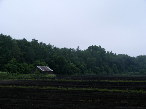
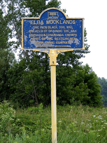
The swamps, from which the Elba mucklands were created, were the Tonawanda and Oak Orchard Marsh. When investors moved in, starting in 1910, past plans were being seriously considered to drain the swamp. The earliest plans to drain the swamp though began in 1902. Mr. Landers of Alabama, NY and Mr. Peter Belson of Oakfield, NY early promoters of the draining. Hearings were held so all towns affected by the draining could have a voice in the process. Most of which were all for it, citing the localized water damage and illnesses caused by the swamps.

Representatives involved in the hearings were the towns affected by the future drainage. These towns were the towns of Barre, Clarendon, Alabama, Shelby, Oakfield, and Elba. Elba's hearing was held on May 13, 1902 and was one that garnered the most interest. The arguments made for draining the swamps were like those made in other towns. The majority view that the swamps caused disease and flood damage. Spectators were in support of the idea too. So as long as the project wouldn't be too costly. It is after these hearings, in August of 1903, that the plans were created to drain the swamp. In the Commission's findings it was declared that a main drainage channel would be started in the eastern area of the swamp and continued in westerly direction and following a path to connect to the Oak Orchard Creek. The plans included widening and deepening the Oak Orchard Creek. Later surveying of the land was used to plan where the lateral channel would be dug. These lateral channels which are still clearly visible in Elba. Specifically within numerous areas of the woods between the eastern segment of Ridge Road and West Muck Road to the North.

Elba, NY

In April and May of 1904, the plans were further declared and the Commission said that all 25,760 acres to be drained could be reclaimed. It was on May, the 4th, that $5,000 would cover the costs of surveying and other initial work prior to drainage. In 1906, the surveyors began working on the early planning stages to drain the swamp. In the spring of 1909, the swamp experienced large scale flooding and looked like a lake at the time. Many roads were flooded under by the rise in water.

The opposite was happening by the fall. A drought over the summer had created conditions that were financially harming farms. Many farmers' properties, including hay and straw crops, were burned in an uncontrolled wildfire. Part of the swamp also ignited after drying out.

In 1910, Professor Carr, from Washington DC, came in to analyze the soil for its viability and quality. By 1911, local newspapers were reporting on the developments. An article in the Daily News, on February 27, 1911, reported that the Big Swamp was soon to be drained. After this, a lot of planning, land dealings, and business dealings occurred. Also, interest in the future mucklands increased. Deals which included companies who'd clear out timber from the drained swamp areas.

Of the acres reclaimed in the draining, 5,721 went to the Town of Alabama, 4,044 to Oakfield, 3,511 to Elba, 524 to Byron, 3,482 to Shelby, 6,117 to Barre, and 2,361 to Clarendon. The contract bidding for the drainage began in January of 1913. The contract was awarded to R.H. and G.A. McWilliams of Chicago. The contract was worth $110,000 and work was to start within 60 days.

Preparations began in April after the arrival of equipment via the West Shore Railroad. The railroad, which existed a short distance past ECS up until the latter 1980s. The dredge, once assembled, would only travel about a 1/2 mile a day. While its destination, at Transit Road, was roughly 6 miles away. The dredge, being so large, telephone wires had to be temporarily removed by telephone linemen. This was done as the machine passed through the Village of Elba. At one point, the dredge broke down at South Main Street. It needed replacement parts, from Evansville, Indiana, that took a week to arrive. After being repaired, the dredge took ten days to reach its Transit Road destination.

Work began on June 6, 1913. The dredges (Bucyrus dredges, i believe) were put into position at Transit Road, at the Oak Orchard Creek. The wooden dredge scow, constructed on the Oak Orchard Creek, that followed the dredges was 20 feet wide and 82 feet long. As the work commenced and the machine moved along many came to Elba to view the machine at work. So many visitors came to see the dredging operations that traffic, on Sundays, was non-stop. At this time, purchasing of land and properties increased in Elba in preparation for the new farmland. By August of 1913, the dredge work was going well and they were progressing by around 600 feet per day. New business kept coming into Elba throughout the rest of 1913 and throughout 1914. Which also brought new families into the area.

By the late summer of 1914, many new farms were in operation and growing crops on the rich mucklands. Others had planted orchards on their new acreage. After a little more than two years of dredging, in December of 1915, the drainage work was done. Dredging equipment returned to its 'home', being taken back along the West Shore Railroad. The efforts of the draining of the swamp contributed greatly to Elba's growth in those earlier days. Those efforts still contribute to the success of Elba's farms still in operation today.

Elba, NY

The downside is that, with every passing season, the Elba mucklands reduce in viability. Fires have occurred on the mucklands during times of drought going back to the 1930s. The Soil Conservation Service, since 1954, has done annual checks on the soil to measure how much has been lost, year-by-year.

Only time will tell how long the Elba mucklands will last before extensive muckland restoration is needed.

Photos from around Elba, Genesee County, New York.

Wednesday, November 02, 2016
Photos from around Elba, Genesee County, New York.
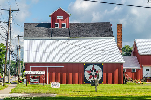
For those that don't know, Elba is a small town in Western New York that's about halfway between Buffalo and Rochester. It's also a short distance away from Batavia, New York and a section of the NYS thruway. Elba is best known for its agriculture, its mucklands, and its well-developed community atmosphere. Find out more about the town by visiting this link here.


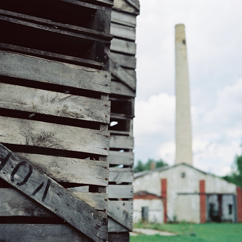
Crates
Smokestack and old, abandoned storage facility.

Elba, NY
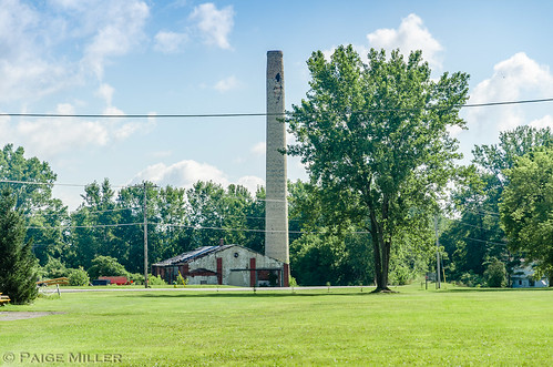
Different shot of abandoned food processing and storage facilty, with smokestack.

Elba, NY
Old train depot that's now a pizza place. The tracks were removed in the late '80s.

Elba, NY
Elba Central School - Built in 1938

Elba, NY
Barn currently housing a business called, "The Mill".

sky 019 sky 013
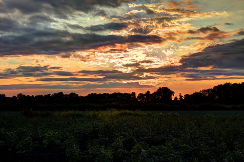
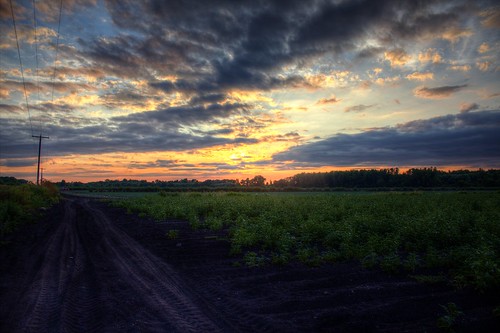
Serene field landscape at sunset

Related:

Katelyn Nicole Davis ? Forever Missed